| |
 TASMANIA, AUSTRALIA'S APPLE ISLE - Nov 2007
(Part 3)
Day 13 Nov 24:
 Today is Federal Election Day but you wouldn�t know it by looking at the sleepy
townships we passed along the way to Russell Falls. We left New Norfolk Caravan
Park just before 9am and headed for the nearest petrol station to top up Just
Trip�n with diesel before driving on the Gordon River Road through Plenty and
Glenora, past several hop plantations and on to Westerway for the turn off to
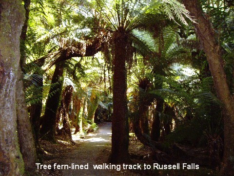
Mt Field National Park to get to Russell Falls. We were both delighted to read
on the info board that it was merely an easy 15 minutes walk to the falls so we
jauntily set off from the car-park, cameras in hand.
Today is Federal Election Day but you wouldn�t know it by looking at the sleepy
townships we passed along the way to Russell Falls. We left New Norfolk Caravan
Park just before 9am and headed for the nearest petrol station to top up Just
Trip�n with diesel before driving on the Gordon River Road through Plenty and
Glenora, past several hop plantations and on to Westerway for the turn off to
Mt Field National Park to get to Russell Falls. We were both delighted to read
on the info board that it was merely an easy 15 minutes walk to the falls so we
jauntily set off from the car-park, cameras in hand.
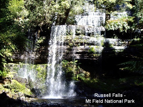
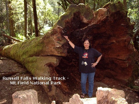
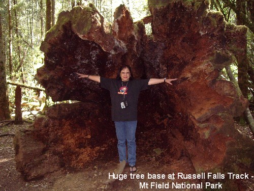
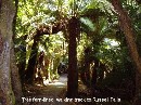
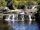
 Our
leisurely saunter on the tree fern-lined footpath over bubbling brooks and huge
old tree stumps were soon rewarded with a spectacular view of the three-tiered
Russell Falls. On the way back we caught a delightful scene of a happy platypus
frolicking in the stream with several small brown trout nonchalantly swimming
around but in my excitement, I wrongly set my camera to landscape so missed out
on some nice photos. Doh! Our
leisurely saunter on the tree fern-lined footpath over bubbling brooks and huge
old tree stumps were soon rewarded with a spectacular view of the three-tiered
Russell Falls. On the way back we caught a delightful scene of a happy platypus
frolicking in the stream with several small brown trout nonchalantly swimming
around but in my excitement, I wrongly set my camera to landscape so missed out
on some nice photos. Doh!
 From Russell Falls, we got back on the Gordon River Road and drove up and round
and around 90km (56 miles) of winding mountain road through the Gordon Forests
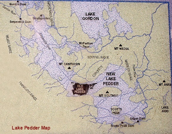
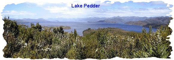
with awesome views of the various ranges as we went along until we reached Lake
Pedder, a former much smaller natural lake flooded by damming in 1972, where we
stopped for a snack of a juicy pear each before continuing on to Lake Gordon.
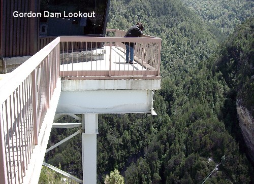
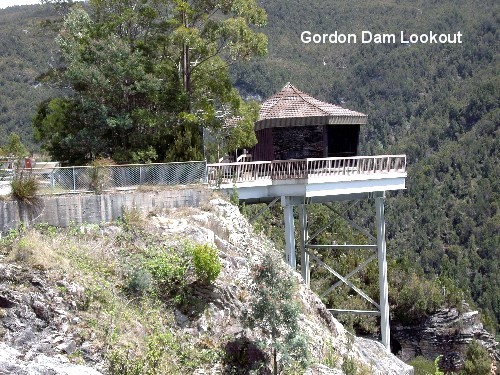
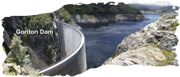
We drove to the road�s end at Gordon Dam where it was so windy and freezing
cold that we simultaneously grabbed our coats before venturing outside Just
Trip�n to snap a few photos of this awesome dam.
From Russell Falls, we got back on the Gordon River Road and drove up and round
and around 90km (56 miles) of winding mountain road through the Gordon Forests
with awesome views of the various ranges as we went along until we reached Lake
Pedder, a former much smaller natural lake flooded by damming in 1972, where we
stopped for a snack of a juicy pear each before continuing on to Lake Gordon.
We drove to the road�s end at Gordon Dam where it was so windy and freezing
cold that we simultaneously grabbed our coats before venturing outside Just
Trip�n to snap a few photos of this awesome dam. 
 It was quite a challenge for me to get onto the viewing platform in the roaring
wind for a few photos that somehow failed to show the true life magnificence of
this great dam and the high altitude we were at. My MOTH couldn�t bring himself
to get onto the platform due to his fear of great heights and satisfied himself
with a few photos from the safe distance of the road. Enough is enough, we
decided, so back on the road we went, back down the steep winding road, smoky
in parts due to a bushfire or two, back to the small town of Westerway to take
us past the picturesque little village of Ellendale with its historic St
Andrews Anglican Church which was built in 1809, to get on the Lyell Highway
and onwards to the hydro-electric village of Wayatinah. We spent the night at
the Wayatinah Lakeside Caravan Park, situated by the Wayatinah Lagoon in
peaceful idyllic surrounds and being CMCA members, it only cost us $15 a night
for a powered site. It was a far cry from the Caravan Park in Cygnet when it
came to views and amenities and at half the price! We were very impressed.
Tonight�s dinner will be home-cooked chicken chow mien served on two minute
noodles before gluing our eyes on the TV set for continuous updates on the
Election results. As widely expected, the Australian Labor Party won the
Federal election.
It was quite a challenge for me to get onto the viewing platform in the roaring
wind for a few photos that somehow failed to show the true life magnificence of
this great dam and the high altitude we were at. My MOTH couldn�t bring himself
to get onto the platform due to his fear of great heights and satisfied himself
with a few photos from the safe distance of the road. Enough is enough, we
decided, so back on the road we went, back down the steep winding road, smoky
in parts due to a bushfire or two, back to the small town of Westerway to take
us past the picturesque little village of Ellendale with its historic St
Andrews Anglican Church which was built in 1809, to get on the Lyell Highway
and onwards to the hydro-electric village of Wayatinah. We spent the night at
the Wayatinah Lakeside Caravan Park, situated by the Wayatinah Lagoon in
peaceful idyllic surrounds and being CMCA members, it only cost us $15 a night
for a powered site. It was a far cry from the Caravan Park in Cygnet when it
came to views and amenities and at half the price! We were very impressed.
Tonight�s dinner will be home-cooked chicken chow mien served on two minute
noodles before gluing our eyes on the TV set for continuous updates on the
Election results. As widely expected, the Australian Labor Party won the
Federal election.
Day 14 Nov 25:
 We left Wayatinah at our usual getaway time of around 9am and got on the Lyell
Highway to Tarraleah to check out Tarraleah Falls. Following the road sign, we
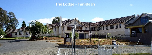
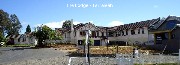
turned off the main road and found ourselves in the vacinity of the 300-acre
estate of "The Lodge", a fancy award winning country retreat hotel which was
originally a chalet for executives from the Tarraleah Hydro-Electric
We left Wayatinah at our usual getaway time of around 9am and got on the Lyell
Highway to Tarraleah to check out Tarraleah Falls. Following the road sign, we
turned off the main road and found ourselves in the vacinity of the 300-acre
estate of "The Lodge", a fancy award winning country retreat hotel which was
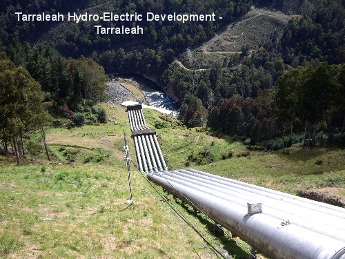
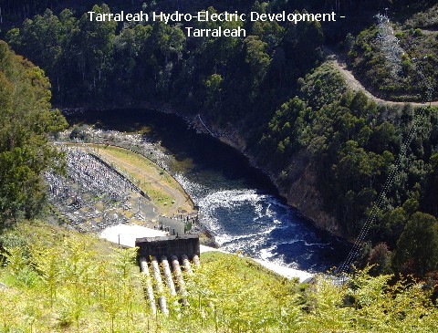
originally a chalet for executives from the Tarraleah Hydro-Electric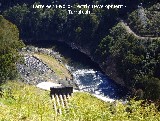 Development nearby and has Tasmania's highest golf course... and its own petrol
station!. We pulled up into a nearby car-park and walked over to have a look at
the Tarraleah Hydro-Electric Development which was commissioned in 1938,
Development nearby and has Tasmania's highest golf course... and its own petrol
station!. We pulled up into a nearby car-park and walked over to have a look at
the Tarraleah Hydro-Electric Development which was commissioned in 1938,
 utilising
the waters of Lake St Clair and the Derwent River. Following a sign pointing in
the direction of Tarraleah Falls, we started off on foot but minutes into the
walk, we both lost interest as the walking track was not signed with the usual
info regarding distance and length of the walk. We hopped back into Just
Trip'n, got back on the highway and traveled on through Wentworth Forest to
Bronte and thence to Derwent Bridge where we stopped to fuel up at the Hungry
Wombat Caf�-cum-petrol station. utilising
the waters of Lake St Clair and the Derwent River. Following a sign pointing in
the direction of Tarraleah Falls, we started off on foot but minutes into the
walk, we both lost interest as the walking track was not signed with the usual
info regarding distance and length of the walk. We hopped back into Just
Trip'n, got back on the highway and traveled on through Wentworth Forest to
Bronte and thence to Derwent Bridge where we stopped to fuel up at the Hungry
Wombat Caf�-cum-petrol station.
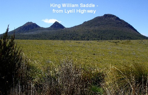
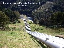
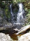
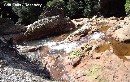
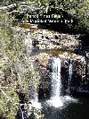
 On and on we traveled on the long and winding road going past King Willam
Saddle, up and down mountains and ranges - past the Raglan Range and through
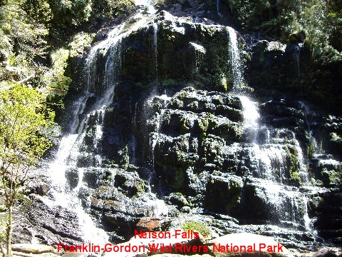
Victoria Pass until we got to Nelson Falls near the Nelson River in the
Franklin-Gordon Wild Rivers National Park.
On and on we traveled on the long and winding road going past King Willam
Saddle, up and down mountains and ranges - past the Raglan Range and through
Victoria Pass until we got to Nelson Falls near the Nelson River in the
Franklin-Gordon Wild Rivers National Park.  A few kilometres up Mt Arrowsmith, we brought Just Trip�n to a screeching halt
at the Surprise Lookout. It was a surprise alright - all we could see were
overgrown bushes hiding the Surprise Valley below. When we reached our
destination, we were pleasantly surprised to find that Nelson Falls was merely
a 20-minute return easy grade walk away from the car-park. Happily we sauntered
along the slightly winding track past a bubbling brook with fingerling trout
swimming around until we reached the viewing platform at the base of the rather
spectacular 35m (115ft) waterfall.
A few kilometres up Mt Arrowsmith, we brought Just Trip�n to a screeching halt
at the Surprise Lookout. It was a surprise alright - all we could see were
overgrown bushes hiding the Surprise Valley below. When we reached our
destination, we were pleasantly surprised to find that Nelson Falls was merely
a 20-minute return easy grade walk away from the car-park. Happily we sauntered
along the slightly winding track past a bubbling brook with fingerling trout
swimming around until we reached the viewing platform at the base of the rather
spectacular 35m (115ft) waterfall.
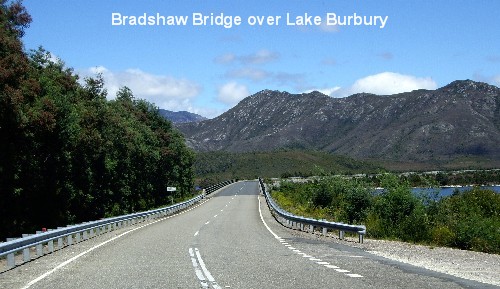
 After viewing Nelson Falls, it was back on the road to travel on over Bradshaw
Bridge to get across Lake Burbury, a 33-sq-mile popular fishing lake. This lake
was man-made for hydro-electricity in the early 1990s and named after Stanley
Burbury, the first Australian-born Governor of Tasmania. We continued on a very
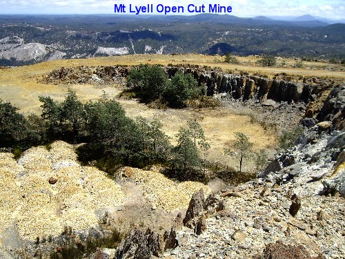
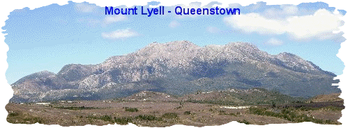
steep (and narrow) winding drive up the West Coast Range to get to the Mt Lyell
Copper Mine. The site was discovered in the 1880s and derived its name from a
880m (2,900ft) peak in the West Coast Range,
After viewing Nelson Falls, it was back on the road to travel on over Bradshaw
Bridge to get across Lake Burbury, a 33-sq-mile popular fishing lake. This lake
was man-made for hydro-electricity in the early 1990s and named after Stanley
Burbury, the first Australian-born Governor of Tasmania. We continued on a very
steep (and narrow) winding drive up the West Coast Range to get to the Mt Lyell
Copper Mine. The site was discovered in the 1880s and derived its name from a
880m (2,900ft) peak in the West Coast Range, 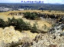
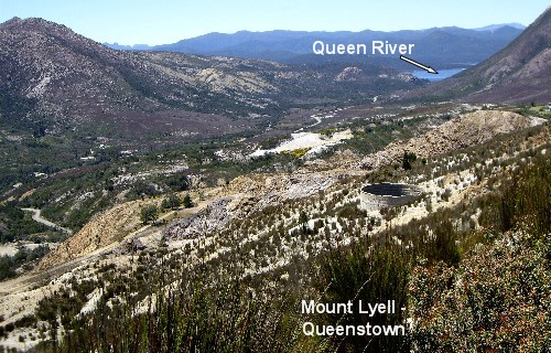
 named after Charles Lyell, the 19th-century English geologist. We clambered
over many, many rocks at the Iron Blow Open Cut Lookout to get a view of the
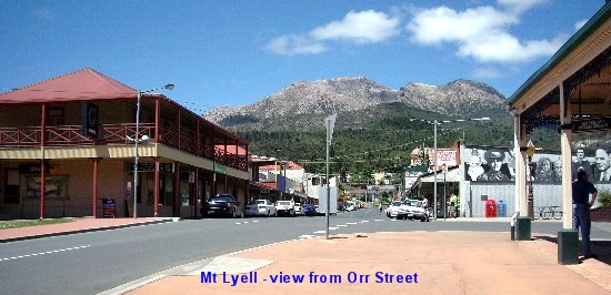
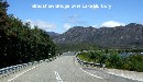
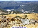
mine with the town of Queenstown way, way down below. From there, it was more
super-steep winding road drive down the range� Just as I was on the verge of
soiling my pants, we reached Queenstown! What a relief to hear the MOTH
reassuring me we would not be going back up the mountain range as we'd be
driving on to the west coastal town of Strahan.
named after Charles Lyell, the 19th-century English geologist. We clambered
over many, many rocks at the Iron Blow Open Cut Lookout to get a view of the
mine with the town of Queenstown way, way down below. From there, it was more
super-steep winding road drive down the range� Just as I was on the verge of
soiling my pants, we reached Queenstown! What a relief to hear the MOTH
reassuring me we would not be going back up the mountain range as we'd be
driving on to the west coastal town of Strahan.
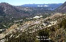
 Queenstown is surrounded by bare hills resembling a moonscape, a legacy of its
past copper mining days when trees were removed for use in the smelters.
Smelter fumes over about
Queenstown is surrounded by bare hills resembling a moonscape, a legacy of its
past copper mining days when trees were removed for use in the smelters.
Smelter fumes over about  40
years and the erosion of the shallow topsoil by heavy annual rainfall do not
help the situation. [Gold and copper were first discovered here in the 1880s,
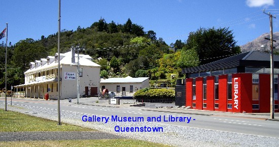
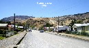
with mining still continuing today.] After the mine, we drove down to
Queenstown and headed for Driffield Street, the main street in the town centre
and surprisingly, it was practically deserted. Today being Sunday, and bearing
in mind Queenstown is, 40
years and the erosion of the shallow topsoil by heavy annual rainfall do not
help the situation. [Gold and copper were first discovered here in the 1880s,
with mining still continuing today.] After the mine, we drove down to
Queenstown and headed for Driffield Street, the main street in the town centre
and surprisingly, it was practically deserted. Today being Sunday, and bearing
in mind Queenstown is,  after all, a mining town, we weren't expecting to see yuppies sipping lattes in
roadside caf�s, � la Melbourne, but it was so much like a ghost town that I
half expected to see some tumbleweed tumbling down the main street! With no
bustling crowd to jostle through, we were able to do a quick lap of the town
centre in peace and quiet.
after all, a mining town, we weren't expecting to see yuppies sipping lattes in
roadside caf�s, � la Melbourne, but it was so much like a ghost town that I
half expected to see some tumbleweed tumbling down the main street! With no
bustling crowd to jostle through, we were able to do a quick lap of the town
centre in peace and quiet.
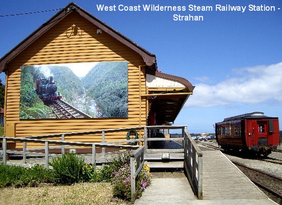
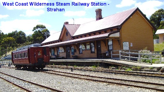
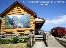
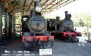
 We looked at various interesting landmarks, including the Abt Wilderness
Railway Station in Driffield Street. The Abt railway system uses a special rail
track that allowed trains to travel up steep inclines; known as the Abt system
after its Swiss inventor, Dr Roman Abt. The original steam railway was built by
We looked at various interesting landmarks, including the Abt Wilderness
Railway Station in Driffield Street. The Abt railway system uses a special rail
track that allowed trains to travel up steep inclines; known as the Abt system
after its Swiss inventor, Dr Roman Abt. The original steam railway was built by
 the Mt
Lyell Mining and Railway Company to transport ore and supplies between
Queenstown and Strahan. When the price of copper collapsed in 1963, the railway
was abandoned. Today the historic Abt Wilderness Railway has been restored and
renamed West Coast Wilderness Railway and is Australia's only rack and pinion
railway transporting tourists to and from Strahan Railway Station and
Queenstown Railway Station. the Mt
Lyell Mining and Railway Company to transport ore and supplies between
Queenstown and Strahan. When the price of copper collapsed in 1963, the railway
was abandoned. Today the historic Abt Wilderness Railway has been restored and
renamed West Coast Wilderness Railway and is Australia's only rack and pinion
railway transporting tourists to and from Strahan Railway Station and
Queenstown Railway Station.
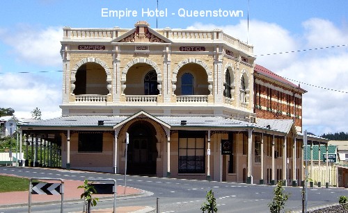
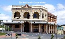
From Queenstown Station, we crossed the road to the Empire Hotel built in 1901
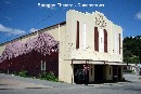 during
the wealthy mining era at the turn of the 20th Century, with a
prominent facade in the town during
the wealthy mining era at the turn of the 20th Century, with a
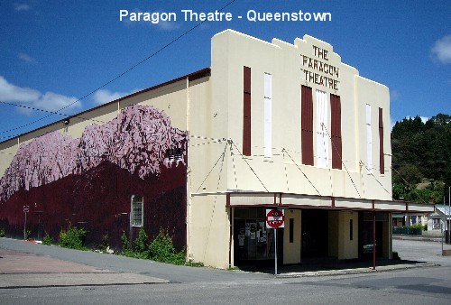
prominent facade in the town  streetscape. A little way into McNamara Street, the side street that runs next
to the hotel, stood the Paragon Theatre which was built in 1932 and in its
heyday, boasted of being "the city theatre in the country" with 1,150 seating
capacity designed for the talking pictures (talkies). It closed its doors 20
years ago and was briefly used as an indoor cricket venue. Currently, it is
being renovated and will re-open as a luxury 60-seat digital cinema.
streetscape. A little way into McNamara Street, the side street that runs next
to the hotel, stood the Paragon Theatre which was built in 1932 and in its
heyday, boasted of being "the city theatre in the country" with 1,150 seating
capacity designed for the talking pictures (talkies). It closed its doors 20
years ago and was briefly used as an indoor cricket venue. Currently, it is
being renovated and will re-open as a luxury 60-seat digital cinema.
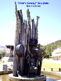
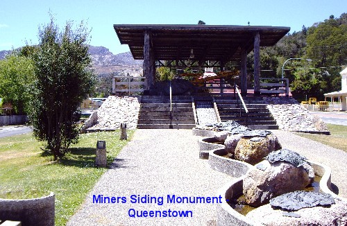
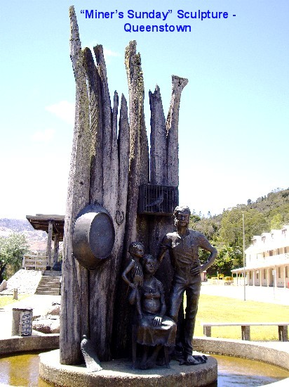
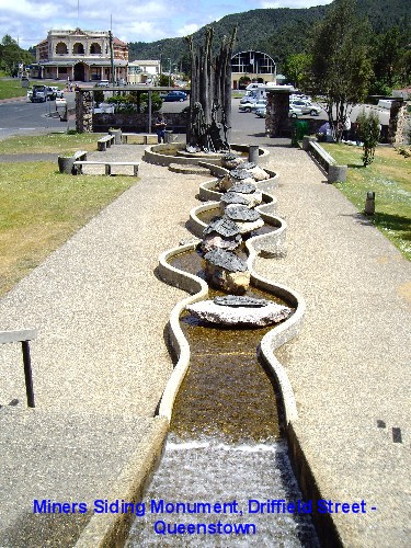
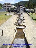 Afterwards, we checked out the uniquely interesting Miners Siding in Driffield
Street with its 21 bronze sculptured plaques mounted on conglomerate boulders,
depicting the changes from the early rough miners' camp to a town and community
of later years. The masterpiece would have to be the "Miner's Sunday" sculpture
by Stephen Walker. The sculpture, commissioned in 1983, is made of bronze and
Huon Pine, and depicts an early miner and his family on the day of rest. The
Miners Siding monument was erected to celebrate over one hundred years of
mining in the area. A few more clicks of our cameras later, we journeyed on�
yep, more winding road all the way to Strahan.
Afterwards, we checked out the uniquely interesting Miners Siding in Driffield
Street with its 21 bronze sculptured plaques mounted on conglomerate boulders,
depicting the changes from the early rough miners' camp to a town and community
of later years. The masterpiece would have to be the "Miner's Sunday" sculpture
by Stephen Walker. The sculpture, commissioned in 1983, is made of bronze and
Huon Pine, and depicts an early miner and his family on the day of rest. The
Miners Siding monument was erected to celebrate over one hundred years of
mining in the area. A few more clicks of our cameras later, we journeyed on�
yep, more winding road all the way to Strahan.
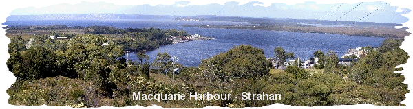
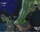
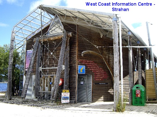
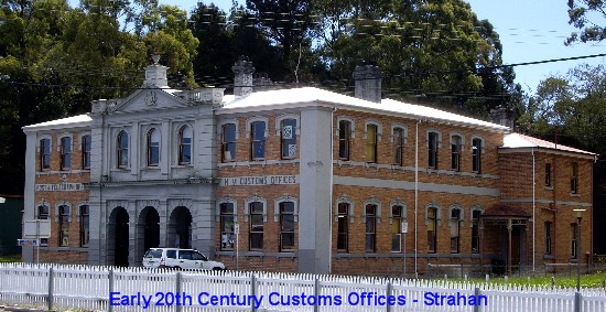
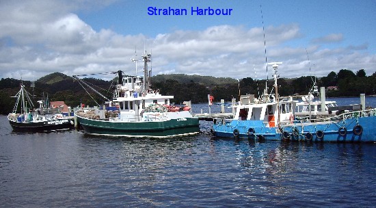
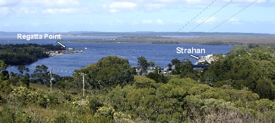
 Strahan (pronounced �Straw-n�) is a working fishing port situated on the
northern end of Macquarie Harbour. The township of Strahan wasn't really
founded until 1877. Prior to that, the small port had been variously known as
Long Bay and Regatta Point but in 1877, it became a vital port for the tin
mines at Mt Heemskirk. It was named after Major George Strahan who was the
Governor of Tasmania from 1881-86. Its main industry in modern times is tourism
as it is the gateway to the south-west wilderness.
Strahan (pronounced �Straw-n�) is a working fishing port situated on the
northern end of Macquarie Harbour. The township of Strahan wasn't really
founded until 1877. Prior to that, the small port had been variously known as
Long Bay and Regatta Point but in 1877, it became a vital port for the tin
mines at Mt Heemskirk. It was named after Major George Strahan who was the
Governor of Tasmania from 1881-86. Its main industry in modern times is tourism
as it is the gateway to the south-west wilderness.
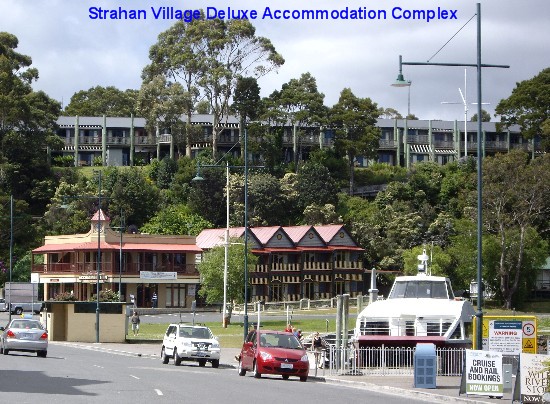
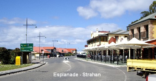
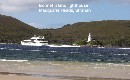
 We arrived there in the afternoon and decided to go for a leisurely stroll in
the main street, the Esplanade, which curves around Strahan Harbour. After
paying two dollars for all day parking in the main car-park, we ambled over to
the Morrisons� Huon Pine Sawmill on the Waterfront, one of the oldest working
mills in
We arrived there in the afternoon and decided to go for a leisurely stroll in
the main street, the Esplanade, which curves around Strahan Harbour. After
paying two dollars for all day parking in the main car-park, we ambled over to
the Morrisons� Huon Pine Sawmill on the Waterfront, one of the oldest working
mills in 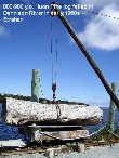 the state, and watched the joiners at work.
 I wasn't interested in purchasing off-cuts of the rare Huon pine so we
moved on to a display on the waterfront - a great big 800 to 900-year-old Huon
Pine log which was felled in the Dennison River in the early 1960s. We
continued on our walk, stopping briefly to look at a few trawlers in the
harbour. During our walk, my MOTH's inbuilt GPS went into action and honed in
on a couple of places selling crayfish so we darted in and eagerly enquired
about the prices. Boy, were we shocked by the big difference in the asking
price when compared to that of the east coastal towns (e.g. Snug) - almost
double the price, as a
I wasn't interested in purchasing off-cuts of the rare Huon pine so we
moved on to a display on the waterfront - a great big 800 to 900-year-old Huon
Pine log which was felled in the Dennison River in the early 1960s. We
continued on our walk, stopping briefly to look at a few trawlers in the
harbour. During our walk, my MOTH's inbuilt GPS went into action and honed in
on a couple of places selling crayfish so we darted in and eagerly enquired
about the prices. Boy, were we shocked by the big difference in the asking
price when compared to that of the east coastal towns (e.g. Snug) - almost
double the price, as a 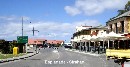 matter of fact. Hopes of another crayfish dinner faded as we left the town
centre to check in at the Cosy Cabins Strahan Seaside for a night�s stay.
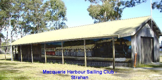
With CMCA discount it cost us $30 for a powered site - not bad at all,
considering it�s only a short stroll to the beach where the Macquarie Sailing
Club shed stands. There was no extra charge for
matter of fact. Hopes of another crayfish dinner faded as we left the town
centre to check in at the Cosy Cabins Strahan Seaside for a night�s stay.
With CMCA discount it cost us $30 for a powered site - not bad at all,
considering it�s only a short stroll to the beach where the Macquarie Sailing
Club shed stands. There was no extra charge for showers and the park is located in quite pretty surrounds within cooee from the
police station.
showers and the park is located in quite pretty surrounds within cooee from the
police station. 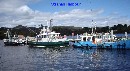 Tonight�s planned dinner was supposed to be fillet steaks, fried onions, gravy
and garden salad but it changed because my MOTH opened a can of mushroom in
butter sauce, instead of beetroot slices, so we ended up having our fillet
steaks with mushroom sauce and tossed garden salad.
Tonight�s planned dinner was supposed to be fillet steaks, fried onions, gravy
and garden salad but it changed because my MOTH opened a can of mushroom in
butter sauce, instead of beetroot slices, so we ended up having our fillet
steaks with mushroom sauce and tossed garden salad.
Day 15 Nov 26:
 We left Strahan Caravan Park around 8.30 in the morning and drove on 15km (9
miles) of the
We left Strahan Caravan Park around 8.30 in the morning and drove on 15km (9
miles) of the 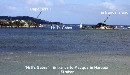 rugged
and gravelly Macquarie Heads Road through Swan Basin State Forest to get to
Ocean Beach, Tasmania's longest beach, stretching over 30km (18.6 miles) in
length. The rocky drive was liberally spiced up by an extensive repertoire of
expletives by my MOTH who didn't fancy having Just Trip'n getting a punctured
tyre out in the middle of Woop-Woop. The purpose of this drive was not because
we wanted to risk taking a dip off Ocean Beach with its strong currents, nor to
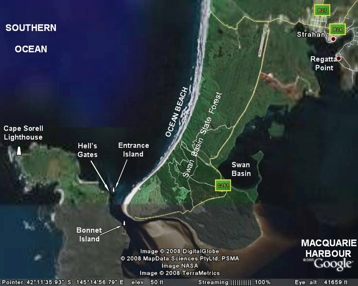
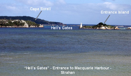
do a spot of fishing. It was to view the narrow 75m-wide (82yds) notoriously
wild mouth of Macquarie Harbour known as �Hell�s Gates�. The actual channel is
between Cape Sorell on the west and Entrance Island on the east. The wider area
of water rugged
and gravelly Macquarie Heads Road through Swan Basin State Forest to get to
Ocean Beach, Tasmania's longest beach, stretching over 30km (18.6 miles) in
length. The rocky drive was liberally spiced up by an extensive repertoire of
expletives by my MOTH who didn't fancy having Just Trip'n getting a punctured
tyre out in the middle of Woop-Woop. The purpose of this drive was not because
we wanted to risk taking a dip off Ocean Beach with its strong currents, nor to
do a spot of fishing. It was to view the narrow 75m-wide (82yds) notoriously
wild mouth of Macquarie Harbour known as �Hell�s Gates�. The actual channel is
between Cape Sorell on the west and Entrance Island on the east. The wider area
of water 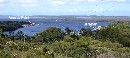 between Entrance Island and Macquarie Head is just too shallow to get a boat
over. We eventually arrived at the camping ground at Macquarie Head where we
met a ranger who took one look at Just Trip'n and advised us against using the
4WD track to Ocean Beach. Instead, he told us to go down the sand dunes and
walk for "a bit"... We found out that his "a bit" equated to over a kilometre
walk on the beach after tackling the super-soft dunes, but we pressed on
until we reached an area where we could put our cameras to good use.
between Entrance Island and Macquarie Head is just too shallow to get a boat
over. We eventually arrived at the camping ground at Macquarie Head where we
met a ranger who took one look at Just Trip'n and advised us against using the
4WD track to Ocean Beach. Instead, he told us to go down the sand dunes and
walk for "a bit"... We found out that his "a bit" equated to over a kilometre
walk on the beach after tackling the super-soft dunes, but we pressed on
until we reached an area where we could put our cameras to good use.
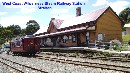 After Hell's Gates, we drove back to the Esplanade for a bit more "look-see"
but the sign-boards that caught our eyes were filled with the �$� signs - most
of the touristy fun things to do were way too costly for us frugal grey nomads.
For example, there are the Gordon River Cruises (Adult from $85 - $180 pp),
World Heritage Cruises (Adult from $65 - $86 pp) and the West Coast Wilderness
Railway between Strahan and Queenstown (Adult $99 Tourist Class, or $185
Premier Carriage, plus $15 return by coach pp).
After Hell's Gates, we drove back to the Esplanade for a bit more "look-see"
but the sign-boards that caught our eyes were filled with the �$� signs - most
of the touristy fun things to do were way too costly for us frugal grey nomads.
For example, there are the Gordon River Cruises (Adult from $85 - $180 pp),
World Heritage Cruises (Adult from $65 - $86 pp) and the West Coast Wilderness
Railway between Strahan and Queenstown (Adult $99 Tourist Class, or $185
Premier Carriage, plus $15 return by coach pp).
 We
shuddered to think what the Wilderness Air or the Strahan Seaplanes and
Helicopter flights would cost. The "Chinese Jew" in me managed to talk my MOTH
out of taking any of the cruises and rail rides and persuaded him to go for
walkabouts instead. We
shuddered to think what the Wilderness Air or the Strahan Seaplanes and
Helicopter flights would cost. The "Chinese Jew" in me managed to talk my MOTH
out of taking any of the cruises and rail rides and persuaded him to go for
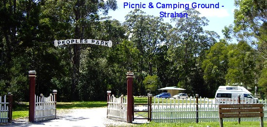
walkabouts instead.  First, we drove up Esk Street which took us into Tamar Street to get to the
Water Tower Hill Lookout for a fantastic view of Macquarie Harbour and the
surrounds. From there, we drove to Peoples Park for a 40 to 50-minute return
2.5km (1.5 miles) easy walk to view Hogarth Falls. From Peoples Park, we drove
to Regatta Point to the Strahan Railway Station to have a look at the rack and
pinion train but unfortunately only a carriage was standing outside the
station. Oh well, back on the road we went, crossing the Henty River to get to
the next historic mining town of Zeehan.
First, we drove up Esk Street which took us into Tamar Street to get to the
Water Tower Hill Lookout for a fantastic view of Macquarie Harbour and the
surrounds. From there, we drove to Peoples Park for a 40 to 50-minute return
2.5km (1.5 miles) easy walk to view Hogarth Falls. From Peoples Park, we drove
to Regatta Point to the Strahan Railway Station to have a look at the rack and
pinion train but unfortunately only a carriage was standing outside the
station. Oh well, back on the road we went, crossing the Henty River to get to
the next historic mining town of Zeehan.
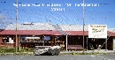
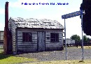
 Zeehan was one of the first places in Tasmania ever seen by Europeans and was
named after the brig of Abel Tasman, the Dutch merchant explorer who, in 1642,
discovered Van Dieman's Land, now called Tasmania. Zeehan became known as �The
Silver City of the West� when Frank Long discovered silver-lead (Galena) on the
banks of Pea Soup Creek in 1882 and within a decade, it grew to become the
third largest town in Tasmania. By 1910 the ore bodies which had sustained
Zeehan began to give out and the town slowly declined. By the 1950s it had a
population of only 650 and the last silver mine in Zeehan closed down in 1960.
Fortunately, it didn't become a ghost town as the town continues to exist and
prosper as workers who work at Renison Bell tin mine, 15km (9 miles) away, live
in Zeehan and commute to work.
Zeehan was one of the first places in Tasmania ever seen by Europeans and was
named after the brig of Abel Tasman, the Dutch merchant explorer who, in 1642,
discovered Van Dieman's Land, now called Tasmania. Zeehan became known as �The
Silver City of the West� when Frank Long discovered silver-lead (Galena) on the
banks of Pea Soup Creek in 1882 and within a decade, it grew to become the
third largest town in Tasmania. By 1910 the ore bodies which had sustained
Zeehan began to give out and the town slowly declined. By the 1950s it had a
population of only 650 and the last silver mine in Zeehan closed down in 1960.
Fortunately, it didn't become a ghost town as the town continues to exist and
prosper as workers who work at Renison Bell tin mine, 15km (9 miles) away, live
in Zeehan and commute to work.
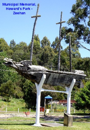
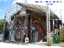
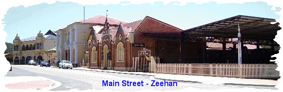
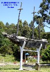
 We pulled up along Main Street to check out an unusual-looking structure that
caught our eyes in Howard's Park. A closer inspection of the plaque beneath
revealed it is a memorial dedicated to R.J. Howard Esq. J.P. who was the
Commissioner of the Zeehan Municipal Commission (1939-53) and Chairman of same
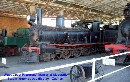
(1954-68). We then crossed Main Street to snap a couple of photos of some old
locomotives
We pulled up along Main Street to check out an unusual-looking structure that
caught our eyes in Howard's Park. A closer inspection of the plaque beneath
revealed it is a memorial dedicated to R.J. Howard Esq. J.P. who was the
Commissioner of the Zeehan Municipal Commission (1939-53) and Chairman of same
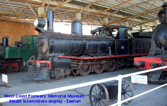
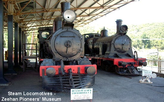
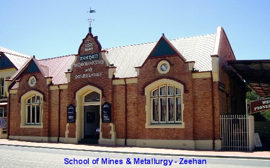
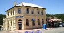
(1954-68). We then crossed Main Street to snap a couple of photos of some old
locomotives 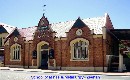
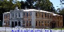
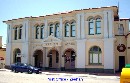 in the West Coast Pioneers' Memorial Museum which is adjoined to the Zeehan
School of Mines and Metallurgy, established in 1892. After more photos of a few
historical buildings along Main Street, we enjoyed a very yummy lunch of a
steakburger each and indulged in a Mango Passion Splice icy pole apiece from
the only takeaway shop in this sleepy township before hitting the road to get
to our next destination, Rosebery.
in the West Coast Pioneers' Memorial Museum which is adjoined to the Zeehan
School of Mines and Metallurgy, established in 1892. After more photos of a few
historical buildings along Main Street, we enjoyed a very yummy lunch of a
steakburger each and indulged in a Mango Passion Splice icy pole apiece from
the only takeaway shop in this sleepy township before hitting the road to get
to our next destination, Rosebery.
 We were merrily driving along more long and winding road before it dawned on us
that we had taken the wrong turn-off instead of the 39km (24 miles) direct
route on the Murchison Zeehan Highway.
We were merrily driving along more long and winding road before it dawned on us
that we had taken the wrong turn-off instead of the 39km (24 miles) direct
route on the Murchison Zeehan Highway. 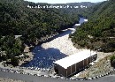 �Not
to worry, it's not like we're in a rush!� my MOTH said cheerily as we continued
on the long 103km (64 miles) loop. As a result of this unplanned detour, we got
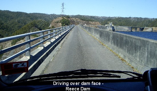
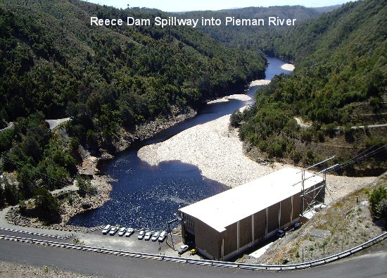
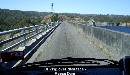
to see the 120m-high (394ft) rock-fill Reece Dam on Lake Pieman. We had to
drive over the dam face and spillway to continue on before re-joining the
Murchison Highway near Tullah. I found the drive across the dam face a little
scary but no worries, we made it just fine. We decided against seeing the
Bastyan Dam as well as the Mackintosh Dam but instead, made our way to Rosebery
to spend the night at the Rosebery Cabin and Tourist Park at CMCA discounted
rate of $22 a night. �Not
to worry, it's not like we're in a rush!� my MOTH said cheerily as we continued
on the long 103km (64 miles) loop. As a result of this unplanned detour, we got
to see the 120m-high (394ft) rock-fill Reece Dam on Lake Pieman. We had to
drive over the dam face and spillway to continue on before re-joining the
Murchison Highway near Tullah. I found the drive across the dam face a little
scary but no worries, we made it just fine. We decided against seeing the
Bastyan Dam as well as the Mackintosh Dam but instead, made our way to Rosebery
to spend the night at the Rosebery Cabin and Tourist Park at CMCA discounted
rate of $22 a night.
 Rosebery is a zinc and gold mining town, nestled on the slopes of Mt Black. In
1893 a gold prospector named Tom McDonald reached Mount Black and staked out a
claim which eventually became the huge mine which today still drives the
economy of Rosebery. Zinc and lead were found in 1894 and by 1897 copper was
being mined at nearby Primrose. Today the Pasminco Zinc Mine is central to the
town's economy.
Rosebery is a zinc and gold mining town, nestled on the slopes of Mt Black. In
1893 a gold prospector named Tom McDonald reached Mount Black and staked out a
claim which eventually became the huge mine which today still drives the
economy of Rosebery. Zinc and lead were found in 1894 and by 1897 copper was
being mined at nearby Primrose. Today the Pasminco Zinc Mine is central to the
town's economy. 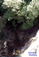 Rosebery
was named after Tom McDonald's company, the Rosebery Gold Mining Company and in
turn, it was named after Lord Rosebery who was Prime Minister of Britain at the
time. Rosebery
was named after Tom McDonald's company, the Rosebery Gold Mining Company and in
turn, it was named after Lord Rosebery who was Prime Minister of Britain at the
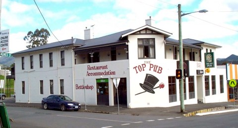
time. 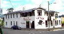 The
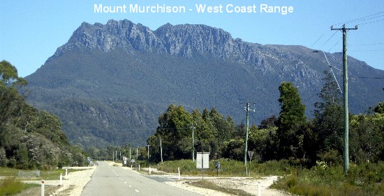
Top Pub, first built in 1930, remains the only hotel in town. The Rosebery
Tourist Park is beautifully located in a picturesque valley with the Murchison
Range on the east side, Mt Black on the northern side and within walking
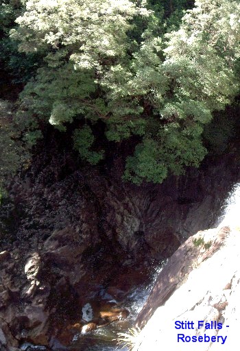
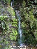
distance to Stitt River and Stitt Falls. After checking in, we went for a
leisurely short stroll to see Stitt Falls which wasn�t at all spectacular but
it was lovely to fall asleep to the sound of the cascading water after an easy
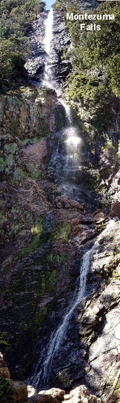
dinner of Spaghetti Bolognaise on toast. Tomorrow, we plan to do the 3-hour
return walk to the 113m (371ft) high Montezuma Falls, Tasmania�s highest
waterfall. The
Top Pub, first built in 1930, remains the only hotel in town. The Rosebery
Tourist Park is beautifully located in a picturesque valley with the Murchison
Range on the east side, Mt Black on the northern side and within walking
distance to Stitt River and Stitt Falls. After checking in, we went for a
leisurely short stroll to see Stitt Falls which wasn�t at all spectacular but
it was lovely to fall asleep to the sound of the cascading water after an easy
dinner of Spaghetti Bolognaise on toast. Tomorrow, we plan to do the 3-hour
return walk to the 113m (371ft) high Montezuma Falls, Tasmania�s highest
waterfall.
Day 16 Nov 27:
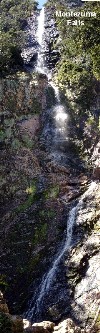
 We left Rosebery about 8.30am with a couple of sweet chilli tuna sandwiches and
two 600ml bottles of cordial drink to see us through our long walk to Montezuma
Falls, Tasmania�s highest waterfall. The name Montezuma comes from the last
Aztec emperor of Mexico (1466-1520) and was applied to the Montezuma Silver
Mining Company formed in 1891 with leases on the northern slopes of Mt Dundas.
We drove 6km (3.7 miles) on the winding road up the West Coast Range and
finally reached the steep very rocky road leading to the car park. Rather
uneasy about driving Just Trip�n down it and unsure of how much further the
car-park was, we decided to park on the side of the road and walk the rest of
the way to the waterfall. The walk to the Falls was 9.6km (6 miles) return from
the start of the track and, including the walk from and back to Just Trip�n, we
calculated our walking distance was at least 11km (6.8 miles). Man, no wonder
our legs were a bit stiff and sore afterwards!
We left Rosebery about 8.30am with a couple of sweet chilli tuna sandwiches and
two 600ml bottles of cordial drink to see us through our long walk to Montezuma
Falls, Tasmania�s highest waterfall. The name Montezuma comes from the last
Aztec emperor of Mexico (1466-1520) and was applied to the Montezuma Silver
Mining Company formed in 1891 with leases on the northern slopes of Mt Dundas.
We drove 6km (3.7 miles) on the winding road up the West Coast Range and
finally reached the steep very rocky road leading to the car park. Rather
uneasy about driving Just Trip�n down it and unsure of how much further the
car-park was, we decided to park on the side of the road and walk the rest of
the way to the waterfall. The walk to the Falls was 9.6km (6 miles) return from
the start of the track and, including the walk from and back to Just Trip�n, we
calculated our walking distance was at least 11km (6.8 miles). Man, no wonder
our legs were a bit stiff and sore afterwards!
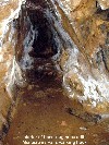
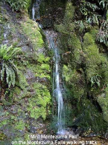
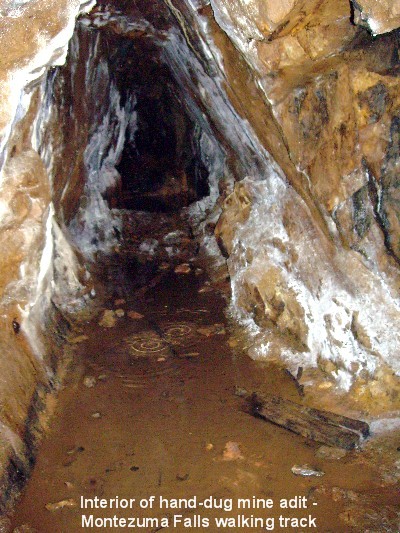
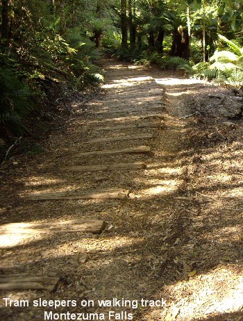
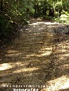
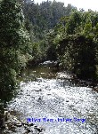
 It was an interesting walking track though, following the historic route of the
former North East Dundas Tramway with the old tram sleepers underfoot in some
areas, miniature waterfalls here and there along the way, sections of boggy
patches to hop, skip and jump over and an old hand-dug mine shaft from bygone
days when tin, gold, silver, lead and zinc were mined and the ore transported
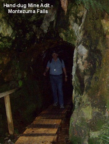
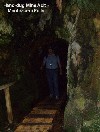
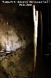
to Zeehan via the tramline. My MOTH couldn't resist venturing into the adit as
far as he could go and after waiting outside for less than a minute, my
curiosity got the better of me and I, too, followed in. We couldn't see much of
the interior as it was dark as night after the first few steps into the adit
but my MOTH managed to snap a photo of it.
It was an interesting walking track though, following the historic route of the
former North East Dundas Tramway with the old tram sleepers underfoot in some
areas, miniature waterfalls here and there along the way, sections of boggy
patches to hop, skip and jump over and an old hand-dug mine shaft from bygone
days when tin, gold, silver, lead and zinc were mined and the ore transported
to Zeehan via the tramline. My MOTH couldn't resist venturing into the adit as
far as he could go and after waiting outside for less than a minute, my
curiosity got the better of me and I, too, followed in. We couldn't see much of
the interior as it was dark as night after the first few steps into the adit
but my MOTH managed to snap a photo of it.
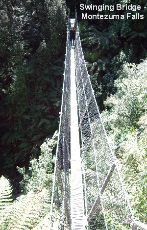
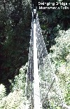 We continued on our walk until, within metres of reaching the viewing area of
the waterfall, there happened to be a long and narrow swinging bridge, only one
"foot-step" wide. My heart sank at the sight but thinking wrongly that we had
to cross the swinging bridge to view the waterfall, I said a quick prayer and
gingerly made my way across. When we got to the other side, the view turned out
to be rather disappointing, so back over the swinging bridge we went. We took
the other little path and within minutes, we found ourselves on a viewing area
at the base of the 104m waterfall, complete with benches to rest our weary
feet! We had our little picnic there in between snapping several photos before
making our way back. The return walk was a bit more laborious as it was mostly
uphill in places but thankfully, it wasn�t a steep incline.
We continued on our walk until, within metres of reaching the viewing area of
the waterfall, there happened to be a long and narrow swinging bridge, only one
"foot-step" wide. My heart sank at the sight but thinking wrongly that we had
to cross the swinging bridge to view the waterfall, I said a quick prayer and
gingerly made my way across. When we got to the other side, the view turned out
to be rather disappointing, so back over the swinging bridge we went. We took
the other little path and within minutes, we found ourselves on a viewing area
at the base of the 104m waterfall, complete with benches to rest our weary
feet! We had our little picnic there in between snapping several photos before
making our way back. The return walk was a bit more laborious as it was mostly
uphill in places but thankfully, it wasn�t a steep incline.
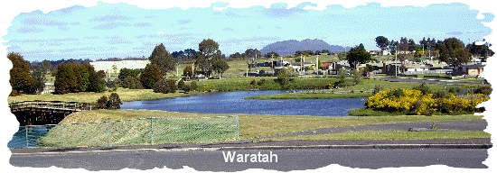
 After Montezuma Falls, it was back in Just Trip�n to drive back to the
Murchison Highway through Rosebery and Tullah before turning off to get to the
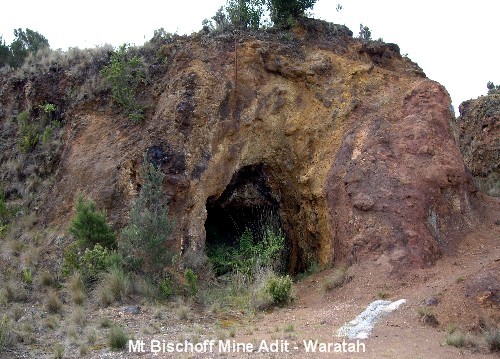
historic township of Waratah which was built around the shoreline of Lake
Waratah. The town came into existence after James 'Philosopher' Smith (who has
been credited with saving the economy of Tasmania with his mineral discoveries)
found the Mt Bischoff tin deposit in 1871. [It was the richest tin mine ever
found in the
After Montezuma Falls, it was back in Just Trip�n to drive back to the
Murchison Highway through Rosebery and Tullah before turning off to get to the
historic township of Waratah which was built around the shoreline of Lake
Waratah. The town came into existence after James 'Philosopher' Smith (who has
been credited with saving the economy of Tasmania with his mineral discoveries)
found the Mt Bischoff tin deposit in 1871. [It was the richest tin mine ever
found in the 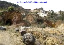 world.]
 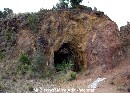 Mt Bischoff was named after Chairman James Bischoff of the Van Diemans Land
Company which had been granted enormous land rights in north west Tasmania in
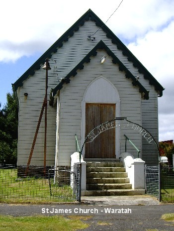
the 1800s. St. James Church in Smith Street was built in 1880 and was the first
church in Tasmania to use an electric light when the manager of Mt Bischoff
mine, H.W.F. Kayser, had the electric light connected to the church in 1889.
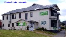
After �checking in� at the Waratah Camping Ground at $20 a night for a powered
site, inclusive of free use of the amenities (showers, toilets and fully
equipped laundry), we went for a driving tour of the old mining township.
Mt Bischoff was named after Chairman James Bischoff of the Van Diemans Land
Company which had been granted enormous land rights in north west Tasmania in
the 1800s. St. James Church in Smith Street was built in 1880 and was the first
church in Tasmania to use an electric light when the manager of Mt Bischoff
mine, H.W.F. Kayser, had the electric light connected to the church in 1889.
After �checking in� at the Waratah Camping Ground at $20 a night for a powered
site, inclusive of free use of the amenities (showers, toilets and fully
equipped laundry), we went for a driving tour of the old mining township.

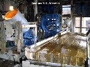
 First, we drove up to the old Mt Bischoff tin mine to have a bit of a poke
around there. We then drove around to check out other places of interest as
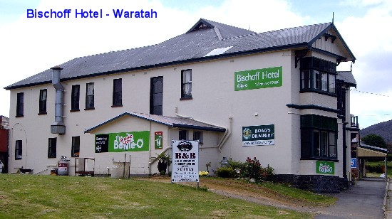
recommended in the visitor's guide. The Bischoff Hotel is a Queen Anne style
heritage listed hotel. The original hotel was built in 1881 and the present
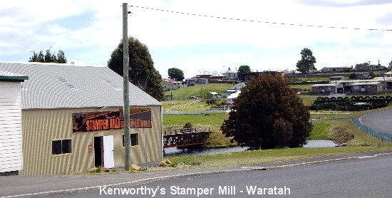
building was erected in 1902. Then there was the Kenworthy's Stamper Mill with
an interesting display of old stamper machinery. My MOTH just couldn't resist
pressing the button that triggered the machinery to briefly come to life for a
quick demonstration of how it used to work in the old days.
First, we drove up to the old Mt Bischoff tin mine to have a bit of a poke
around there. We then drove around to check out other places of interest as
recommended in the visitor's guide. The Bischoff Hotel is a Queen Anne style
heritage listed hotel. The original hotel was built in 1881 and the present
building was erected in 1902. Then there was the Kenworthy's Stamper Mill with
an interesting display of old stamper machinery. My MOTH just couldn't resist
pressing the button that triggered the machinery to briefly come to life for a
quick demonstration of how it used to work in the old days.
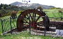
 After our driving tour, we headed back to the Camping Ground and hooked up Just
Trip'n
After our driving tour, we headed back to the Camping Ground and hooked up Just
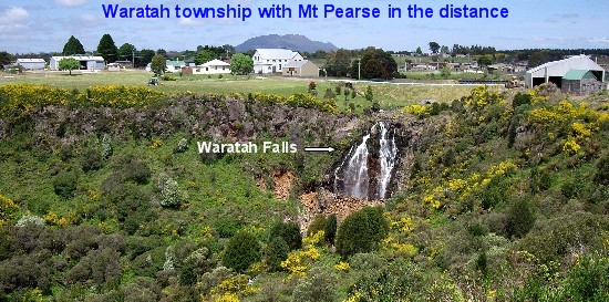
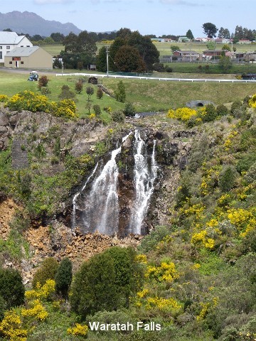
Trip'n  to the power-point before setting off on foot to view Waratah Falls, the
Water Wheel, the remnant of the old Railway iron bridge across Lake Waratah and
the unusual 2-level Lake Waratah. The higher level was created over 100 years
ago to guarantee water supply to the mine site. The lower level was created by
the town council in 1979 after a to the power-point before setting off on foot to view Waratah Falls, the
Water Wheel, the remnant of the old Railway iron bridge across Lake Waratah and
the unusual 2-level Lake Waratah. The higher level was created over 100 years
ago to guarantee water supply to the mine site. The lower level was created by
the town council in 1979 after a
 severe flood washed out the road crossing above the waterfall.
 We then decided
to call it quits for the day and leisurely strolled back to Just Trip'n to
commence our evening routine. Bugger! No TV reception here so we were reduced
to using the �wireless� to listen to the news but not to worry, still many,
many movies on DVDs for us to watch through tired half-shut eyes. Dinner
consisted of Lamb Tomato Curry and rice. Tomorrow it is onwards to Cradle
Mountain� We then decided
to call it quits for the day and leisurely strolled back to Just Trip'n to
commence our evening routine. Bugger! No TV reception here so we were reduced
to using the �wireless� to listen to the news but not to worry, still many,
many movies on DVDs for us to watch through tired half-shut eyes. Dinner
consisted of Lamb Tomato Curry and rice. Tomorrow it is onwards to Cradle
Mountain�
Day 17 Nov 28:

 I woke up early to the quacking of a few wild ducks so out came my camera for a
few pics on my way to the ladies bathroom. After our usual morning cup of
coffee, we headed off to the dumping station nearby to empty our toilet tank.
While the MOTH was doing the dirty work, he noticed a sign which pointed to
another waterfall viewing area and suggested that I should check it out. Ever
eager to do as I�m told, I merrily toddled off to do so and I walked and walked
further and further downhill, only to find another sign that said, �Track to
base of Waterfall�. Not knowing the distance or difficulty level, I decided
against taking that walk, so huffing and panting, I made my way back uphill. I
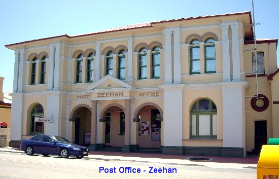
went on to snap a few photos of the museum and post office while my MOTH went
into the post office to sign the visitors� guestbook.
I woke up early to the quacking of a few wild ducks so out came my camera for a
few pics on my way to the ladies bathroom. After our usual morning cup of
coffee, we headed off to the dumping station nearby to empty our toilet tank.
While the MOTH was doing the dirty work, he noticed a sign which pointed to
another waterfall viewing area and suggested that I should check it out. Ever
eager to do as I�m told, I merrily toddled off to do so and I walked and walked
further and further downhill, only to find another sign that said, �Track to
base of Waterfall�. Not knowing the distance or difficulty level, I decided
against taking that walk, so huffing and panting, I made my way back uphill. I
went on to snap a few photos of the museum and post office while my MOTH went
into the post office to sign the visitors� guestbook.
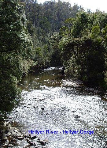
 From Waratah, we travelled on to check out Hellyer Gorge and we both felt
rather disappointed to find that it is actually a roadside rest area and
camping ground with a wee walk (15min return) along the bank of the Hellyer
River to the bridge. Oh well, we might as well do the walk and stretch our legs
anyway, so off we trotted, snapping a couple of photos along the way before
walking back to the camping area via the road� Highlight of the Hellyer Gorge
stop was meeting fellow tourists who, as it turned out, were the same couple we
had said 'G'day' to at Montezuma Falls yesterday. A further chat revealed that
they hailed from Bribie Island, Queensland, not far from where we used to
reside. A small world indeed! We then went our separate ways - they, onwards to
Stanley and us, to Cradle Mountain.
From Waratah, we travelled on to check out Hellyer Gorge and we both felt
rather disappointed to find that it is actually a roadside rest area and
camping ground with a wee walk (15min return) along the bank of the Hellyer
River to the bridge. Oh well, we might as well do the walk and stretch our legs
anyway, so off we trotted, snapping a couple of photos along the way before
walking back to the camping area via the road� Highlight of the Hellyer Gorge
stop was meeting fellow tourists who, as it turned out, were the same couple we
had said 'G'day' to at Montezuma Falls yesterday. A further chat revealed that
they hailed from Bribie Island, Queensland, not far from where we used to
reside. A small world indeed! We then went our separate ways - they, onwards to
Stanley and us, to Cradle Mountain.
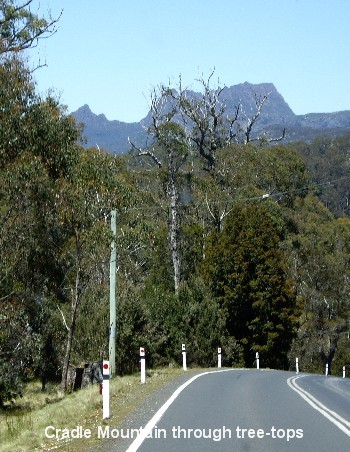
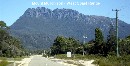
 Cradle Mountain forms the northern end of the Cradle Mountain-Lake St. Clair
National Park
Cradle Mountain forms the northern end of the Cradle Mountain-Lake St. Clair
National Park and is the starting point for the world-famous 'Overland Track', a 6-day walk
through mountainous terrain with icy streams, glacial lakes and a wealth of
wildlife. The mountain was named in 1827 by Joseph Fossey, an explorer, who
thought it looked like a cradle. In 1813, explorer Henry Hellyer became the
first European to successfully reach the summit. We reached Cradle Mountain and
found that it was too touristy for our liking with not really all that much to
interest us.
and is the starting point for the world-famous 'Overland Track', a 6-day walk
through mountainous terrain with icy streams, glacial lakes and a wealth of
wildlife. The mountain was named in 1827 by Joseph Fossey, an explorer, who
thought it looked like a cradle. In 1813, explorer Henry Hellyer became the
first European to successfully reach the summit. We reached Cradle Mountain and
found that it was too touristy for our liking with not really all that much to
interest us.  Just before noon, we were approached by a tourist who wondered if we would be
interested in sharing the cost of one of the Cradle Mountain Helicopters scenic
flights for the princely sum of $190 pp. She was desperately asking around for
another couple to split the cost with, as otherwise, she and her partner would
be up for the family (2 adults & 2 children) rate of $660! We wished her
good luck as she raced off in search of willing sharers before the scheduled
1.15pm flight.
Just before noon, we were approached by a tourist who wondered if we would be
interested in sharing the cost of one of the Cradle Mountain Helicopters scenic
flights for the princely sum of $190 pp. She was desperately asking around for
another couple to split the cost with, as otherwise, she and her partner would
be up for the family (2 adults & 2 children) rate of $660! We wished her
good luck as she raced off in search of willing sharers before the scheduled
1.15pm flight.
 By now our belly worms were starting to growl something fierce so we went to
the Cradle Mountain Caf� for a couple of pepper steak pies and a serve of
potato wedges. When our order arrived we were amazed at the huge box of potato
wedges staring us in the face. It came complete with a small tub of sour cream
and another of sweet chilli sauce. So we ate and we ate but despite our valiant
attempt, we just couldn�t finish it all. The pies cost $4.50 each and the
potato wedges was $5.00. Just as well I only ordered a single serve! After
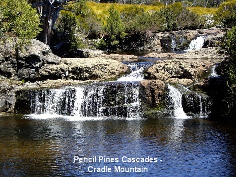
lunch we went for a short walk to view the Pencil Pine Falls. As we walked
along the Dove Lake road on our way to the Visitor Information Centre, we came
across the Pencil Pines Cascades, so naturally out came my camera. We
eventually made our way to the boardwalk for a quick trot around to view the
Pencil Pine Falls and after that, we were done with the Cradle Mountain scene,
as the rest of the walks were way too long for us to handle on this trip
anyway.
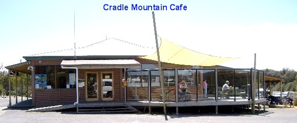
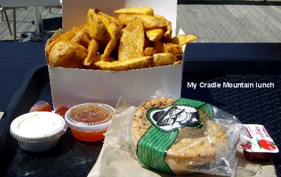
By now our belly worms were starting to growl something fierce so we went to
the Cradle Mountain Caf� for a couple of pepper steak pies and a serve of
potato wedges. When our order arrived we were amazed at the huge box of potato
wedges staring us in the face. It came complete with a small tub of sour cream
and another of sweet chilli sauce. So we ate and we ate but despite our valiant
attempt, we just couldn�t finish it all. The pies cost $4.50 each and the
potato wedges was $5.00. Just as well I only ordered a single serve! After
lunch we went for a short walk to view the Pencil Pine Falls. As we walked
along the Dove Lake road on our way to the Visitor Information Centre, we came
across the Pencil Pines Cascades, so naturally out came my camera. We
eventually made our way to the boardwalk for a quick trot around to view the
Pencil Pine Falls and after that, we were done with the Cradle Mountain scene,
as the rest of the walks were way too long for us to handle on this trip
anyway.
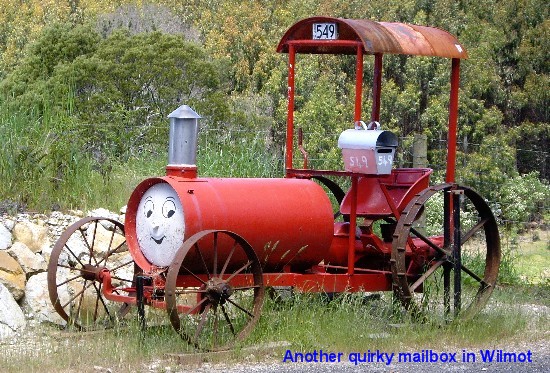
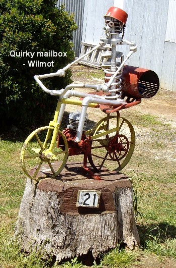
 Back we jumped into Just Trip�n to travel on to Wilmot to view the quirky
letterboxes as stated in their travel blurb. Another round of disappointment as
there weren�t as many as we were expecting. I took photos of a few interesting
ones before leaving the area to travel on yet more steep and winding roads
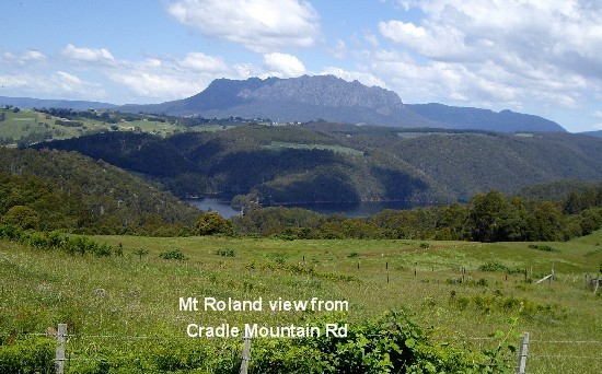
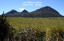
through the Mersey State Forest, up Round Mountain, stopping at the Round
Mountain Lookout for spectacular views of the surrounding mountains, including
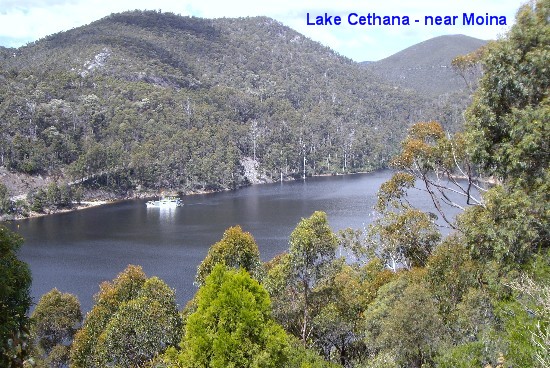
Mt Roland. We turned off Cradle Mountain Road into Cethana Road, stopping
briefly to view Lake Cethana and the Power Station before traveling on into
Mole Creek Karst National Park to Mole Creek to spend the night at Mole Creek
Caravan Park (CMCA discounted fee of $18 a night).
Back we jumped into Just Trip�n to travel on to Wilmot to view the quirky
letterboxes as stated in their travel blurb. Another round of disappointment as
there weren�t as many as we were expecting. I took photos of a few interesting
ones before leaving the area to travel on yet more steep and winding roads
through the Mersey State Forest, up Round Mountain, stopping at the Round
Mountain Lookout for spectacular views of the surrounding mountains, including
Mt Roland. We turned off Cradle Mountain Road into Cethana Road, stopping
briefly to view Lake Cethana and the Power Station before traveling on into
Mole Creek Karst National Park to Mole Creek to spend the night at Mole Creek
Caravan Park (CMCA discounted fee of $18 a night).
 Mole Creek is a tiny little township at the edge of the Great Western Tiers,
72km (45 miles) west of Launceston. The town was named after a nearby creek
which disappears underground "like a mole" because the area is predominantly
limestone. The town has become well known for its excellent leatherwood honey
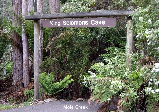
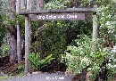
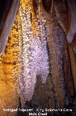
and the two nearby cave systems, the Marakoopa Cave and King Solomon Cave. The
Mole Creek Caravan Park is picturesquely
Mole Creek is a tiny little township at the edge of the Great Western Tiers,
72km (45 miles) west of Launceston. The town was named after a nearby creek
which disappears underground "like a mole" because the area is predominantly
limestone. The town has become well known for its excellent leatherwood honey
and the two nearby cave systems, the Marakoopa Cave and King Solomon Cave. The
Mole Creek Caravan Park is picturesquely situated with Western Tiers to the west, well-fed sheep grazing contently in a
paddock next to the park, Mersey Hill to the north and the bubbling Sassafras
Creek running right alongside the caravan park on the eastern side. We had
dinner of fillet steak with peas & corn and a garden salad. Darn it! No TV
reception here so I missed out on watching the final of �The Farmer Takes A
Wife� reality TV show. Tonight's entertainment? Choice of movies on DVDs.
Tomorrow should be a better touring day as guided tours of the Mole Creek Caves
in Mole Creek Karst National Park, Tasmania�s only Underground National Park,
are on the agenda.
situated with Western Tiers to the west, well-fed sheep grazing contently in a
paddock next to the park, Mersey Hill to the north and the bubbling Sassafras
Creek running right alongside the caravan park on the eastern side. We had
dinner of fillet steak with peas & corn and a garden salad. Darn it! No TV
reception here so I missed out on watching the final of �The Farmer Takes A
Wife� reality TV show. Tonight's entertainment? Choice of movies on DVDs.
Tomorrow should be a better touring day as guided tours of the Mole Creek Caves
in Mole Creek Karst National Park, Tasmania�s only Underground National Park,
are on the agenda.
Day 18 Nov 29:
 I was awakened in the middle of the night to the sound of falling rain... so
far, we have been blessed with glorious weather so hopefully, our second last
day here will be another pleasant day, too. We got going at 8.30am and looking
at the overcast sky and fog over the surrounding mountains, we were ever so
glad that we didn�t have to drive up those mountains today. We headed straight
for the ticket office of Mole Creek Caves but we were a bit early as the centre
was still closed. It opened a few minutes earlier than usual when the ranger
noticed us and another couple of tourists waiting for service.
I was awakened in the middle of the night to the sound of falling rain... so
far, we have been blessed with glorious weather so hopefully, our second last
day here will be another pleasant day, too. We got going at 8.30am and looking
at the overcast sky and fog over the surrounding mountains, we were ever so
glad that we didn�t have to drive up those mountains today. We headed straight
for the ticket office of Mole Creek Caves but we were a bit early as the centre
was still closed. It opened a few minutes earlier than usual when the ranger
noticed us and another couple of tourists waiting for service.
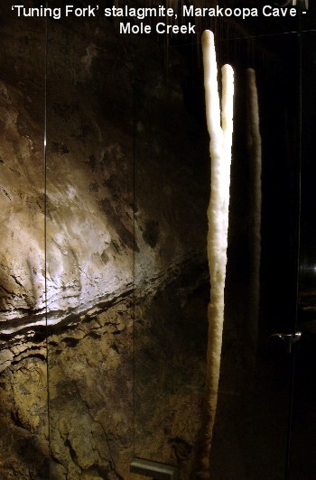
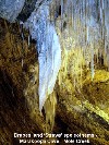
 [There
are two different tours in Marakoopa Cave: one is the 'Underground Rivers and
Glow-worms' and the other is the 'Cathedral, Gardens and Glow-worms'.
We opted for the Underground Rivers tour in the lower chamber which is suitable
for all ages and levels of fitness as the Cathedral tour is more suitable for [There
are two different tours in Marakoopa Cave: one is the 'Underground Rivers and
Glow-worms' and the other is the 'Cathedral, Gardens and Glow-worms'.
We opted for the Underground Rivers tour in the lower chamber which is suitable
for all ages and levels of fitness as the Cathedral tour is more suitable for
 those with a higher level of fitness as it includes the stairway to the Great
Cathedral.] We were first in line to be served and I gleefully pointed out the
sign advertising a 20% discount for a tour of a second cave to my MOTH. I
produced the 10% discount coupon that was handed out upon our arrival off the
Spirit of Tasmania and together with my MOTH�s Senior's Card, we ended up
paying $43.70 to tour both Marakoopa Cave and King Solomon's Cave, instead of
$60. Bonus!!!
those with a higher level of fitness as it includes the stairway to the Great
Cathedral.] We were first in line to be served and I gleefully pointed out the
sign advertising a 20% discount for a tour of a second cave to my MOTH. I
produced the 10% discount coupon that was handed out upon our arrival off the
Spirit of Tasmania and together with my MOTH�s Senior's Card, we ended up
paying $43.70 to tour both Marakoopa Cave and King Solomon's Cave, instead of
$60. Bonus!!!
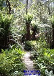
 We decided to drive from the ticket office car-park to the Marakoopa (Tasmanian
Aboriginal word meaning �handsome�) Cave car-park as we didn�t want to risk
missing the 11.30am tour of King Solomon's Cave 11km (7 miles) drive away for
the sake of a 20-minute return walk through the Fernglade Walking Track. We
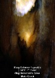
took our time strolling to the Cave entrance and when the tour guide arrived
for the 10am scheduled tour, there were 21 of us eagerly waiting to enter the
cave to be amazed. It was an
We decided to drive from the ticket office car-park to the Marakoopa (Tasmanian
Aboriginal word meaning �handsome�) Cave car-park as we didn�t want to risk
missing the 11.30am tour of King Solomon's Cave 11km (7 miles) drive away for
the sake of a 20-minute return walk through the Fernglade Walking Track. We
took our time strolling to the Cave entrance and when the tour guide arrived
for the 10am scheduled tour, there were 21 of us eagerly waiting to enter the
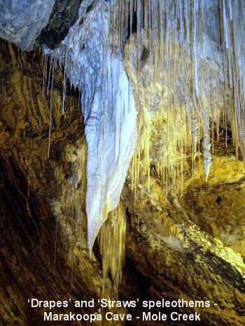
cave to be amazed. It was an 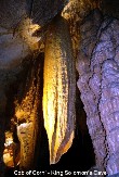 exciting
experience checking out the limestone cave with its large caverns, rim pools,
reflection pools, shawl and flowstone features to the sound of running water in
the two underground streams - the short stream runs for 7km (4.3 miles) while
the long stream runs for a couple of kilometres. Go exciting
experience checking out the limestone cave with its large caverns, rim pools,
reflection pools, shawl and flowstone features to the sound of running water in
the two underground streams - the short stream runs for 7km (4.3 miles) while
the long stream runs for a couple of kilometres. Go
 figure!
Fifty minutes later, almost at the end of the tour, just prior to exiting the
cave, we were told to put away our cameras for the grand finale of our
underground tour. We all stood with bated breaths as the guide switched off all
the lights... The whole tour group gave a collective gasp of, �Awwww�� at the
sight of the glow-worms on the ceiling of the cave. It was like looking at the
Milky Way galaxy of stars... it was awesome! [The karst streams that flow
through the cave allow glow worms to survive.] figure!
Fifty minutes later, almost at the end of the tour, just prior to exiting the
cave, we were told to put away our cameras for the grand finale of our
underground tour. We all stood with bated breaths as the guide switched off all
the lights... The whole tour group gave a collective gasp of, �Awwww�� at the
sight of the glow-worms on the ceiling of the cave. It was like looking at the
Milky Way galaxy of stars... it was awesome! [The karst streams that flow
through the cave allow glow worms to survive.]
 As soon as the tour ended, my MOTH and I made a mad dash to get to the site of
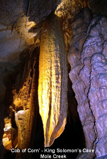
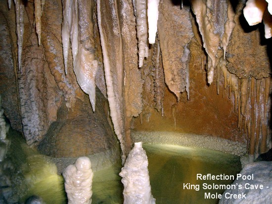
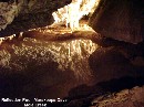
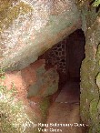
 King Solomon�s Cave for the 11.30am tour. How glad we were that we decided to
take both cave tours as the compact cave system of King Solomon�s Cave turned
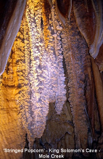
out to be much more spectacular than we had expected. King Solomon�s Cave is a
dry cave with no running stream and no glow-worms as Marakoopa Cave is the only
glow worm cave in Tasmania that is open to the public but there are elaborate
geological formations of stalactites, stalagmites, numerous shawls, stunning
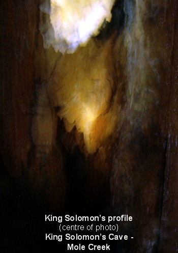
reflecting calcite crystals known as King Solomon�s Diamonds and a stalactite
formation that resembled the profile of King Solomon keeping watch over his
treasure, the reason for this breathtakingly beautiful limestone cave�s name.
King Solomon�s Cave for the 11.30am tour. How glad we were that we decided to
take both cave tours as the compact cave system of King Solomon�s Cave turned
out to be much more spectacular than we had expected. King Solomon�s Cave is a
dry cave with no running stream and no glow-worms as Marakoopa Cave is the only
glow worm cave in Tasmania that is open to the public but there are elaborate
geological formations of stalactites, stalagmites, numerous shawls, stunning
reflecting calcite crystals known as King Solomon�s Diamonds and a stalactite
formation that resembled the profile of King Solomon keeping watch over his
treasure, the reason for this breathtakingly beautiful limestone cave�s name.
 By the time we left King Solomon's Cave, our bellies were growling big time for
 some tucker, so we decided to satisfy our hunger with a feed at 41o South
Salmon Farm on Montana Road in Deloraine. Coincidentally, a billboard on the
side of the highway advertised free salmon products tasting for visitors to the
salmon farm... Anyway, after a bit of a drive in the bush, we reached their
premises and a sampling of the goodies on offer soon got our tastebuds longing
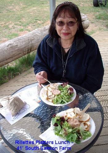
for more. We sat down to a lunch of a Rillettes Platter each, (tub of smoked
salmon rillettes, melba toast and mixed salad leaves with olive oil vinegarette
dressing) at $9.90 a head. SUPER YUMMY!
some tucker, so we decided to satisfy our hunger with a feed at 41o South
Salmon Farm on Montana Road in Deloraine. Coincidentally, a billboard on the
side of the highway advertised free salmon products tasting for visitors to the
salmon farm... Anyway, after a bit of a drive in the bush, we reached their
premises and a sampling of the goodies on offer soon got our tastebuds longing
for more. We sat down to a lunch of a Rillettes Platter each, (tub of smoked
salmon rillettes, melba toast and mixed salad leaves with olive oil vinegarette
dressing) at $9.90 a head. SUPER YUMMY!
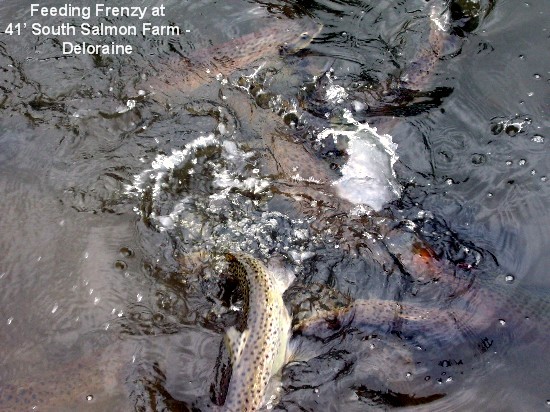
 After lunch, we went for a self-guided tour around the farm at the cost of $10
for adults, $7 for seniors. We were given a bag of fish pellets so we could
feed the salmon in the three feeding ponds. What fun we had watching the salmon
and trout jumping over one another in a feeding frenzy. That done, we continued
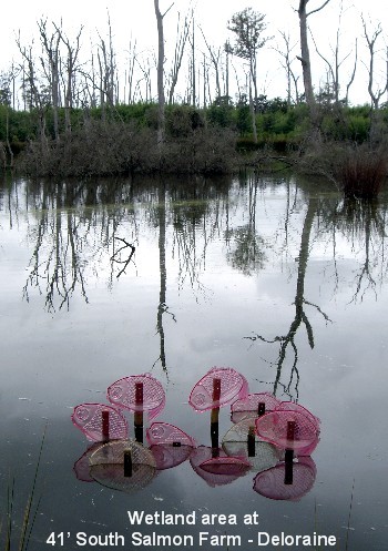
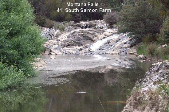
on our walk along Western Rivulet to view the wee Montana Falls and then around
the wetland grasses and woodland areas before a quick lap of the ginseng
plantation. A glance at his watch caused my MOTH to give me the "Hurry up!"
After lunch, we went for a self-guided tour around the farm at the cost of $10
for adults, $7 for seniors. We were given a bag of fish pellets so we could
feed the salmon in the three feeding ponds. What fun we had watching the salmon
and trout jumping over one another in a feeding frenzy. That done, we continued
on our walk along Western Rivulet to view the wee Montana Falls and then around
the wetland grasses and woodland areas before a quick lap of the ginseng
plantation. A glance at his watch caused my MOTH to give me the "Hurry up!"
 look
so after purchasing a nice bottle of Huon River 2004 Pinot Noir for my MOTH and
a whole smoked salmon to take back to Melbourne, we continued on our merry way.
When I had a sip of the Pinot Noir later on in the evening, I turned up my nose
at it - needed sweetening, I reckoned� I'm certainly no connoisseur of wine. To
me, wine smells (and tastes) like rotten grapes...] look
so after purchasing a nice bottle of Huon River 2004 Pinot Noir for my MOTH and
a whole smoked salmon to take back to Melbourne, we continued on our merry way.
When I had a sip of the Pinot Noir later on in the evening, I turned up my nose
at it - needed sweetening, I reckoned� I'm certainly no connoisseur of wine. To
me, wine smells (and tastes) like rotten grapes...]
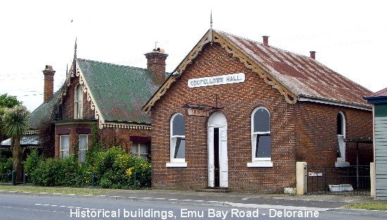
 Where
was I? Oh yeah, we stopped briefly at Deloraine, a charming town located on the
banks of the Meander River, renown for its Where
was I? Oh yeah, we stopped briefly at Deloraine, a charming town located on the
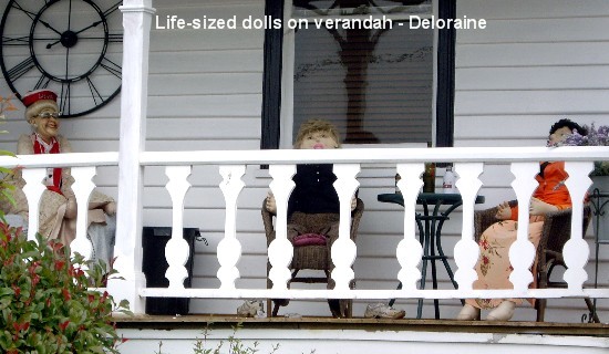
banks of the Meander River, renown for its 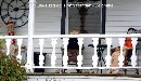 "Sculpture
Trail" with 33 sculptures through the main street of town and along the
river-walk. I managed to take photos of a few of the sculptures and a couple of
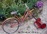
front yard features that caught my eye, namely, a verandah with life-sized
dolls seated at a table enjoying their drinks and what I decided to name "a
ride-on mower", all the while with the MOTH breathing down my neck! He had a
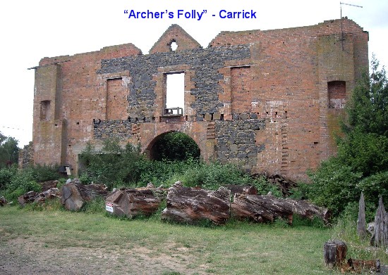
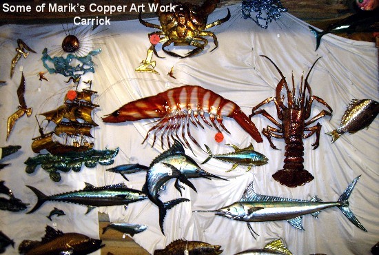
damn good reason though, I wanted to go to Carrick to get to Marik�s Copper
& Metal Art Gallery, situated next to �Archer�s Folly�, before it closes at
5pm. "Sculpture
Trail" with 33 sculptures through the main street of town and along the
river-walk. I managed to take photos of a few of the sculptures and a couple of
front yard features that caught my eye, namely, a verandah with life-sized
dolls seated at a table enjoying their drinks and what I decided to name "a
ride-on mower", all the while with the MOTH breathing down my neck! He had a
damn good reason though, I wanted to go to Carrick to get to Marik�s Copper
& Metal Art Gallery, situated next to �Archer�s Folly�, before it closes at
5pm.
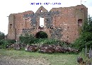
 �Archer�s Folly� is the name given to the ruins of a two-storey mansion built
by local businessman, Mr. John Kinder Archer, shortly after his marriage to
Eliza Palmer in 1847. Only the front of the mansion was built and the dwelling
was never completed or used for its original purpose due to financial setbacks.
In 1867, Thomas Monds purchased �The Folly� and used it as a grain store and in
recent years, Mr. Mirek Marik, a talented copper-work artist, bought the
building and restored it in part, using it as a showcase for his work.
�Archer�s Folly� was destroyed by fire in April 1978 and is now listed in the
Tasmanian Heritage Register. The Marik family have constructed a studio next to
the gutted building.
�Archer�s Folly� is the name given to the ruins of a two-storey mansion built
by local businessman, Mr. John Kinder Archer, shortly after his marriage to
Eliza Palmer in 1847. Only the front of the mansion was built and the dwelling
was never completed or used for its original purpose due to financial setbacks.
In 1867, Thomas Monds purchased �The Folly� and used it as a grain store and in
recent years, Mr. Mirek Marik, a talented copper-work artist, bought the
building and restored it in part, using it as a showcase for his work.
�Archer�s Folly� was destroyed by fire in April 1978 and is now listed in the
Tasmanian Heritage Register. The Marik family have constructed a studio next to
the gutted building.
 We arrived at the gallery with enough time to briefly marvel at over 2,000
pieces of fantastic metal art work of one very talented Tom Marik who had
learnt the skills and knowledge from his dad, Mirek. Regretting that it was
almost closing time, we hurried along on our little tour of the studio and left
after purchasing a couple of pairs of earrings as presents for Gen�s coming
birthday and a couple of fridge magnets to add to my collection.
We arrived at the gallery with enough time to briefly marvel at over 2,000
pieces of fantastic metal art work of one very talented Tom Marik who had
learnt the skills and knowledge from his dad, Mirek. Regretting that it was
almost closing time, we hurried along on our little tour of the studio and left
after purchasing a couple of pairs of earrings as presents for Gen�s coming
birthday and a couple of fridge magnets to add to my collection.
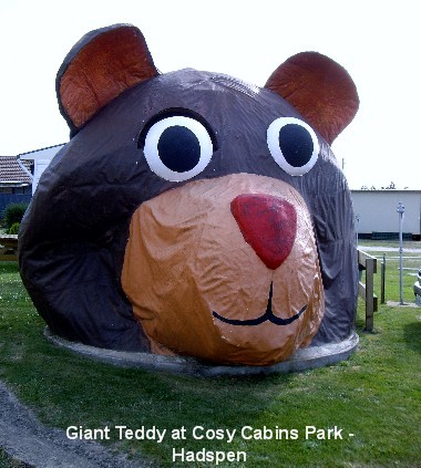
 From Carrick, we drove on to Hadspen, a small historic town on the banks of the
South Esk River, just west of Launceston, to spend our final night in Tasmania
at the Launceston Cabin and Tourist Park at CMCA discounted price of $30 a
night. I was in no mood to do any cooking so we decided to have takeaway dinner
instead. Visions of a hearty meal went out the window when we studied the menu
board in the general store nearby. Eventually, we settled for a steak sandwich
and a pineapple fritter each as well as half a dozen lamingtons to go with our
coffee afterwards. Tomorrow will be our final day on this great island so we
will be heading to Devonport to spend the day there before boarding the Spirit
of Tasmania to return to the mainland.
From Carrick, we drove on to Hadspen, a small historic town on the banks of the
South Esk River, just west of Launceston, to spend our final night in Tasmania
at the Launceston Cabin and Tourist Park at CMCA discounted price of $30 a
night. I was in no mood to do any cooking so we decided to have takeaway dinner
instead. Visions of a hearty meal went out the window when we studied the menu
board in the general store nearby. Eventually, we settled for a steak sandwich
and a pineapple fritter each as well as half a dozen lamingtons to go with our
coffee afterwards. Tomorrow will be our final day on this great island so we
will be heading to Devonport to spend the day there before boarding the Spirit
of Tasmania to return to the mainland.
Day 19 Nov 30:
 I woke up this morning with the sad realization that our Tasmanian holiday is
coming to a close� After our usual breakfast of coffee, we pulled out of the
Launceton Cabin and Tourist Park, topped up Just Trip�n with diesel and began
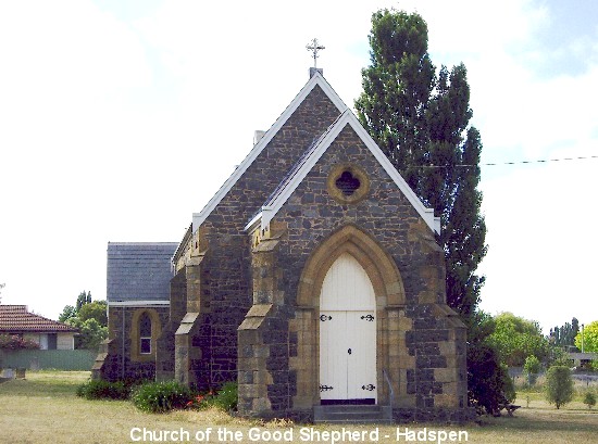
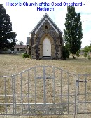
our slow drive to Devonport. On the way out of town we passed the Church of the
Good Shepherd, one of two historic churches in Hadpspen with an amazing
history.
I woke up this morning with the sad realization that our Tasmanian holiday is
coming to a close� After our usual breakfast of coffee, we pulled out of the
Launceton Cabin and Tourist Park, topped up Just Trip�n with diesel and began
our slow drive to Devonport. On the way out of town we passed the Church of the
Good Shepherd, one of two historic churches in Hadpspen with an amazing
history. 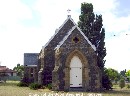 Thomas
Haydock Reibey, (his son, Thomas, became prime minister of Tasmania in 1866-7)
the owner of Entally House (one of the most impressive historic homes in
Tasmania), agreed to pay for the construction of the church until he had an
argument with the Bishop, after which he withdrew his support. Local gossip
suggests that the Bishop, having discovered that Reibey had a sexual preference
for young boys, refused to accept the 'tainted' funds for the building of a
church. The result was that the plans were drawn up in 1857, the foundation
stone was laid in 1868 but the church wasn't completed and dedicated until
1961. Thomas
Haydock Reibey, (his son, Thomas, became prime minister of Tasmania in 1866-7)
the owner of Entally House (one of the most impressive historic homes in
Tasmania), agreed to pay for the construction of the church until he had an
argument with the Bishop, after which he withdrew his support. Local gossip
suggests that the Bishop, having discovered that Reibey had a sexual preference
for young boys, refused to accept the 'tainted' funds for the building of a
church. The result was that the plans were drawn up in 1857, the foundation
stone was laid in 1868 but the church wasn't completed and dedicated until
1961.
 From Hadspen, we went to Westbury thinking that we may go for a wander at the
Westbury Maze, described as one of the best mazes in Australia but too
impatient to wait half an hour till opening time, we continued on to Deloraine,
passing numerous opium poppy plantations along the way. [The Tasmanian Poppy
From Hadspen, we went to Westbury thinking that we may go for a wander at the
Westbury Maze, described as one of the best mazes in Australia but too
impatient to wait half an hour till opening time, we continued on to Deloraine,
passing numerous opium poppy plantations along the way. [The Tasmanian Poppy
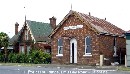 industry
supplies 50% of the world�s medicinal morphine, codeine and thebaine.] We made
a stop at Deloraine for a walk along the Sculpture Trail so I could snap yet
more photos of the sculptures (and of a building or two) while the MOTH held up
the local branch of our bank demanding some cash. I ended up with photos of
almost all of the sculptures on the Sculpture Trail, a project that was
initiated in 1997 by the Deloraine Rotary Club. industry
supplies 50% of the world�s medicinal morphine, codeine and thebaine.] We made
a stop at Deloraine for a walk along the Sculpture Trail so I could snap yet
more photos of the sculptures (and of a building or two) while the MOTH held up
the local branch of our bank demanding some cash. I ended up with photos of
almost all of the sculptures on the Sculpture Trail, a project that was
initiated in 1997 by the Deloraine Rotary Club.
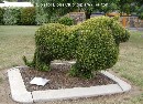
 Next stop was Railton, Tasmania's Town of Topiary, a town built on
industrial heritage and now developing its future through its quaint living
topiaries (sculptured plants) dotted along its streets. We didn�t check them
all out of course, as it would have taken up too much time. I took photos of
some interesting-looking topiaries as well as that of The Kings Hall which was
erected in honour of His Majesty King George V in 1926. From Railton, it was
onwards to Devonport with the hope of purchasing some freshly cooked crays to
take back to Melbourne.
Next stop was Railton, Tasmania's Town of Topiary, a town built on
industrial heritage and now developing its future through its quaint living
topiaries (sculptured plants) dotted along its streets. We didn�t check them
all out of course, as it would have taken up too much time. I took photos of
some interesting-looking topiaries as well as that of The Kings Hall which was
erected in honour of His Majesty King George V in 1926. From Railton, it was
onwards to Devonport with the hope of purchasing some freshly cooked crays to
take back to Melbourne.
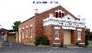 When we reached Devonport, we pulled into the council car-park and popped in a
dollar coin for an hour�s parking time with the MOTH muttering darkly under his
breath something about hating the thought of having to race back to the
fornicating meter every hour to feed the bloody thing. We walked briskly to the
Devonport Visitors Information Centre where a lovely receptionist (Irish lady
in her 70s named Brigid) was able to help us locate the fresh seafood place
whose business name I vaguely remembered � Petuna Seafoods. However, I stopped
in the middle of a gleeful �whoopee� when she told us that she doubted it would
be open for business as it happened to be the Devonport Show weekend. Just to
be sure, she rang up to make an enquiry for us and yes indeed, it was closed
for business� When the MOTH lamented about the parking situation, Brigid again
proved to be most helpful and gave us directions to a free car park.
When we reached Devonport, we pulled into the council car-park and popped in a
dollar coin for an hour�s parking time with the MOTH muttering darkly under his
breath something about hating the thought of having to race back to the
fornicating meter every hour to feed the bloody thing. We walked briskly to the
Devonport Visitors Information Centre where a lovely receptionist (Irish lady
in her 70s named Brigid) was able to help us locate the fresh seafood place
whose business name I vaguely remembered � Petuna Seafoods. However, I stopped
in the middle of a gleeful �whoopee� when she told us that she doubted it would
be open for business as it happened to be the Devonport Show weekend. Just to
be sure, she rang up to make an enquiry for us and yes indeed, it was closed
for business� When the MOTH lamented about the parking situation, Brigid again
proved to be most helpful and gave us directions to a free car park.
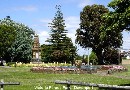
 We left the Info Centre armed with not only a town map of Devonport but also a
walking tour map of the area. Off we went as directed and were fortunate enough
to get a parking space near the War Memorial at Regatta Point. What a lovely
park! It has a unique fountain sundial, the Wilson Solaqueous Fountain which
uses water and sun to show the Eastern Standard Time. We then wandered down a
couple of blocks to the Devonport Showground, thinking it would be a good way
to while away a couple of hours but the
We left the Info Centre armed with not only a town map of Devonport but also a
walking tour map of the area. Off we went as directed and were fortunate enough
to get a parking space near the War Memorial at Regatta Point. What a lovely
park! It has a unique fountain sundial, the Wilson Solaqueous Fountain which
uses water and sun to show the Eastern Standard Time. We then wandered down a
couple of blocks to the Devonport Showground, thinking it would be a good way
to while away a couple of hours but the 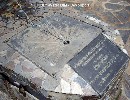 wafting aroma of
  cow dung and horse manure that greeted our nostrils on approaching the entrance
gate didn�t do much for us, so we opted against paying $15 pp to see the 'pong'
producers in the flesh. Instead we walked further on to the town centre and
dropped in at the Noodle Box for a feed of Fried Kway Teow for me and Seafood
Fried Noodles for my MOTH. We have definitely tasted better noodle meals but at
least it kept our belly worms quiet.
cow dung and horse manure that greeted our nostrils on approaching the entrance
gate didn�t do much for us, so we opted against paying $15 pp to see the 'pong'
producers in the flesh. Instead we walked further on to the town centre and
dropped in at the Noodle Box for a feed of Fried Kway Teow for me and Seafood
Fried Noodles for my MOTH. We have definitely tasted better noodle meals but at
least it kept our belly worms quiet.
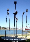
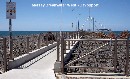 We sauntered down Victoria Parade to get back to Just Trip�n and were intrigued
by the sight of a clump of huge metal poppies in the park. A closer inspection
revealed it to be the 2003 "From Vision To Reality" poppies sculpture by Peter
Hjort - a sculptured masterpiece to honour Stephen King - no, no, not the
American author, but Stephen King, the pioneer of the Tasmanian Poppy Industry.
When we got back to our motor-home, I change my footwear from thongs to runners
before we went for more "walkies", this time to Mersey Breakwater West which
provided lovely views of Devonport at the mouth of the Mersey River and also
Mersey Bluff jutting into Bass Strait. Not wanting to risk losing our parking
spot, we decided to stay put and not drive over to Mersey Bluff to check out
the lighthouse, lookout and blowhole.
We sauntered down Victoria Parade to get back to Just Trip�n and were intrigued
by the sight of a clump of huge metal poppies in the park. A closer inspection
revealed it to be the 2003 "From Vision To Reality" poppies sculpture by Peter
Hjort - a sculptured masterpiece to honour Stephen King - no, no, not the
American author, but Stephen King, the pioneer of the Tasmanian Poppy Industry.
When we got back to our motor-home, I change my footwear from thongs to runners
before we went for more "walkies", this time to Mersey Breakwater West which
provided lovely views of Devonport at the mouth of the Mersey River and also
Mersey Bluff jutting into Bass Strait. Not wanting to risk losing our parking
spot, we decided to stay put and not drive over to Mersey Bluff to check out
the lighthouse, lookout and blowhole.
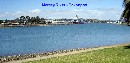
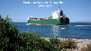 By this time, the number of vehicles in the car park had risen dramatically
with the majority of them sharing the common intention of waiting to board the
Spirit of Tasmania at 5.30pm. We had the option of gazing dreamily into each
other�s eyes or watch the world go by and decided to go with the latter. While
idly looking about, we saw a big container ship sail out of Devonport, right
past a fisherman in his wee boat who didn�t move out of the ship�s path until
the very last moment, causing an audible gasp from those of us watching the
incident from the shore. We wondered if the fisherman WAS wearing brown pants�
By this time, the number of vehicles in the car park had risen dramatically
with the majority of them sharing the common intention of waiting to board the
Spirit of Tasmania at 5.30pm. We had the option of gazing dreamily into each
other�s eyes or watch the world go by and decided to go with the latter. While
idly looking about, we saw a big container ship sail out of Devonport, right
past a fisherman in his wee boat who didn�t move out of the ship�s path until
the very last moment, causing an audible gasp from those of us watching the
incident from the shore. We wondered if the fisherman WAS wearing brown pants�
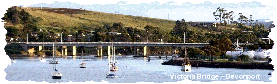
At a few minutes past 5pm a couple of
the vehicles began to leave the scene so we got changed into fresh clothing
before following suit. We drove across Victoria Bridge to the Ferry Terminal in
East Devonport and joined the queue to board the Spirit of Tasmania II. We
passed through customs and security checks hassle-free, parked Just Trip�n and
made our way to our allocated ocean view recliners on Deck 8 before wandering
down to Deck 7 where all the action's at.
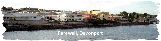
While the MOTH succumbed to his thirst
for an ice cold pot of beer, I gave in to my will power and wandered into the
Admiral�s Gaming Lounge� I got so carried away that I forgot all about the
eatery closing time and by the time we raced over to it at a bit after 9pm,
there was nothing left on offer, so the MOTH had to make do with a snack of a
sausage roll from the bar, washed down with a glass of red while I had a meat
pie. Back I went into the Gaming Lounge and continued playing with my up and
down fortune until midnight, when I decided to call it quits. The MOTH noted
that it took me almost 4 hours of play to win a measly $10 but at least I had
my pokies fix. We then made our way back up to Deck 8 and slept through most of
the ultra smooth voyage back to Station Pier, Melbourne, docking at 7am, on Dec
1st.
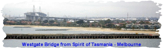
In conclusion, I must say we had a
fantastic road trip holiday in Australia�s mountainous Apple Isle with
wonderful friendly folks ever eager to be helpful to visitors to their island.
A memorable holiday indeed with spectacular landscapes and seascapes, pretty,
tidy townships wherever we went and if we had any complaints at all, it would
have to be the seemingly never-ending winding mountainous roads, some of which
I found to be hair-raising. The weather has been very, very kind to us with
glorious sunshine almost every day of our visit. We look forward to a return
visit to Tasmania, our beautiful Apple Isle.
OzLadyM
  
Border: BoogieJack
Copyright � 2008
OzLadyM
Please do not use any material on this website without my permission. Thank
you.
|