| |
 TASMANIA, AUSTRALIA'S APPLE ISLE - Nov 2007
(Part 2)
Day 8 Nov 19:
 I woke up on my birthday to another glorious Tasmanian morning and after
receiving a phone call with warm birthday wishes from my son, we drove out of
Triabunna at 9.15am to get to our next destination, the Tasman Peninsula. As we
reached the coastal hamlet of Orford, centred around the mouth of the Prosser
River, both the MOTH and I just about choked with the stench in the air - I was
convinced that all of the town folks must have had a damn good feed of curried
eggs, baked beans and cabbage the previous night and simultaneously dropped
their guts just as we drove past! We couldn�t get out of town fast enough.
I woke up on my birthday to another glorious Tasmanian morning and after
receiving a phone call with warm birthday wishes from my son, we drove out of
Triabunna at 9.15am to get to our next destination, the Tasman Peninsula. As we
reached the coastal hamlet of Orford, centred around the mouth of the Prosser
River, both the MOTH and I just about choked with the stench in the air - I was
convinced that all of the town folks must have had a damn good feed of curried
eggs, baked beans and cabbage the previous night and simultaneously dropped
their guts just as we drove past! We couldn�t get out of town fast enough.
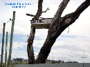
 After passing the township of Buckland, on our approach to the township of
Runnymede, we passed two unusually named hills: Break-Me-Neck Hill and then a
little further on, Bust-Me-Gall Hill, both with incredibly steep inclines and
declines. It is believed that early settlers and travelers used these terms to
describe the steep hills and the names simply stuck. Just as we got to Sorell,
our mobile phone rang again, this time it was a birthday call from Nina. Soon
afterwards, I received an SMS from Sharon wishing me a very happy birthday.
After passing the township of Buckland, on our approach to the township of
Runnymede, we passed two unusually named hills: Break-Me-Neck Hill and then a
little further on, Bust-Me-Gall Hill, both with incredibly steep inclines and
declines. It is believed that early settlers and travelers used these terms to
describe the steep hills and the names simply stuck. Just as we got to Sorell,
our mobile phone rang again, this time it was a birthday call from Nina. Soon
afterwards, I received an SMS from Sharon wishing me a very happy birthday.
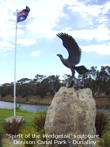
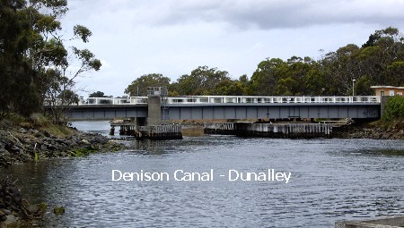
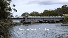
 From Sorell, we took the Arthur Highway and made a brief stop at Dunalley to
learn a little more about the Denison Canal. Dunalley is a small fishing
village south-east of Hobart en route to Port Arthur, located on a narrow
isthmus that joins the Forestier and Tasman Peninsulas to the island of
Tasmania. The Denison Canal project of joining Frederick Henry Bay and Blackman
Bay began in 1901 when it was hand-dug and finally completed in 1905. The Canal
has a swing bridge for road traffic and allows boats easy access between the
two bays.
From Sorell, we took the Arthur Highway and made a brief stop at Dunalley to
learn a little more about the Denison Canal. Dunalley is a small fishing
village south-east of Hobart en route to Port Arthur, located on a narrow
isthmus that joins the Forestier and Tasman Peninsulas to the island of
Tasmania. The Denison Canal project of joining Frederick Henry Bay and Blackman
Bay began in 1901 when it was hand-dug and finally completed in 1905. The Canal
has a swing bridge for road traffic and allows boats easy access between the
two bays. 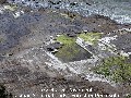 Local
legend has it that the 'toll' to the gatekeeper used to be a bottle of beer. In
1965 a new hydraulic swing bridge replaced the original bridge. We then
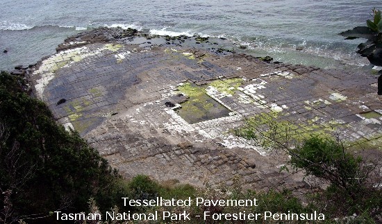
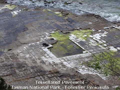
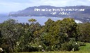
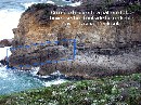
continued on to the Tasman National Park Lookout on the Forestier Peninsula,
just before Eaglehawk Neck (a narrow isthmus about 400m (1312ft) long and under
30m (98ft) wide at its narrowest point making it a natural gateway to the
Tasman Peninsula), to admire great views of Pirates Bay before proceeding to
view the Tessellated Pavement. Local
legend has it that the 'toll' to the gatekeeper used to be a bottle of beer. In
1965 a new hydraulic swing bridge replaced the original bridge. We then
continued on to the Tasman National Park Lookout on the Forestier Peninsula,
just before Eaglehawk Neck (a narrow isthmus about 400m (1312ft) long and under
30m (98ft) wide at its narrowest point making it a natural gateway to the
Tasman Peninsula), to admire great views of Pirates Bay before proceeding to
view the Tessellated Pavement.
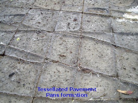
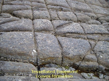
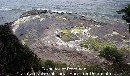
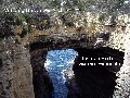
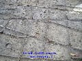 The Tessellated Pavement is a rare sedimentary rock formation caused by
erosion, so named because it fractures into blocks that appear like tiles, with
'pans' and 'loaves' features.
The Tessellated Pavement is a rare sedimentary rock formation caused by
erosion, so named because it fractures into blocks that appear like tiles, with
'pans' and 'loaves' features. 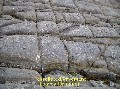 [Away from the seashore, the pavement dries out for longer periods at low tide,
allowing greater development of salt crystals. The salt that forms on the
surface erodes the pavement's surface quicker than the joints, resulting in the
surface of the pavement being lowered while the joints which erode more slowly
become rims, giving the appearance of 'pans'. 'Loaves' features occur when the
joints are eroding quicker than the surface because of abrasion by sand and
other particles carried by water.]
[Away from the seashore, the pavement dries out for longer periods at low tide,
allowing greater development of salt crystals. The salt that forms on the
surface erodes the pavement's surface quicker than the joints, resulting in the
surface of the pavement being lowered while the joints which erode more slowly
become rims, giving the appearance of 'pans'. 'Loaves' features occur when the
joints are eroding quicker than the surface because of abrasion by sand and
other particles carried by water.]
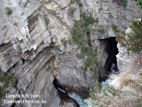
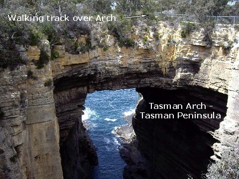
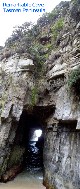
 After checking out this fascinating feature, we drove through Eaglehawk Neck
into the Tasman Peninsula and onwards to the Blowhole, Tasman Arch and the 60m
(197ft) deep Devil's Kitchen, all magnificent rock creations of Father Time
that began some 250 million years ago. We had lunch of a cray roll each from a
mobile caf� in the carpark of the Tasman Arch tourist attraction. From there it
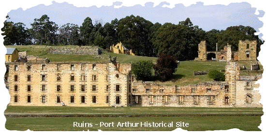
was onwards to Port Arthur, a settlement that started out as a timber station
in 1830 but best known for being a penal colony for secondary offenders (those
who re-offended after their arrival in Australia) from 1833 until 1850s. We
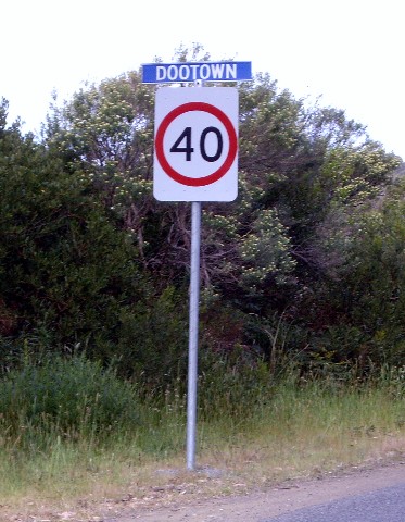
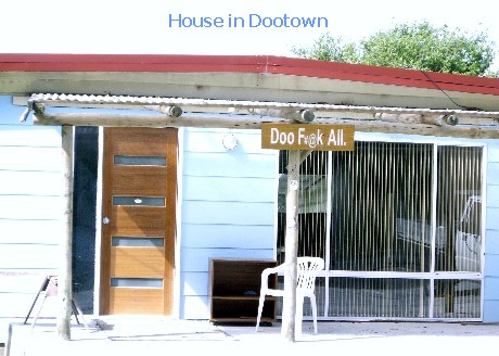
passed a quaint little holiday village called Doo Town on the way, where the
residents have given their homes cute and clever names like �Love Me Doo�,
�Just Doo It�, �Doo Nix�, �Doo Drop In�, �Doo Little� and the one we liked the
best, �Doo F#@k All�.
After checking out this fascinating feature, we drove through Eaglehawk Neck
into the Tasman Peninsula and onwards to the Blowhole, Tasman Arch and the 60m
(197ft) deep Devil's Kitchen, all magnificent rock creations of Father Time
that began some 250 million years ago. We had lunch of a cray roll each from a
mobile caf� in the carpark of the Tasman Arch tourist attraction. From there it
was onwards to Port Arthur, a settlement that started out as a timber station
in 1830 but best known for being a penal colony for secondary offenders (those
who re-offended after their arrival in Australia) from 1833 until 1850s. We
passed a quaint little holiday village called Doo Town on the way, where the
residents have given their homes cute and clever names like �Love Me Doo�,
�Just Doo It�, �Doo Nix�, �Doo Drop In�, �Doo Little� and the one we liked the
best, �Doo F#@k All�.
 Instead of stopping at Port Arthur, we traveled on for a drive around the
Tasman Peninsula to check out the sights, eventually deciding to stop for the
night at the White Beach Tourist Park on the outskirt of the township of
Nubeena. Hopeful enquiries by the MOTH at the manager�s office regarding a nice
restaurant to go for dinner to celebrate my birthday revealed that the RSL Club
do not serve meals on Mondays and the nearest pub is several kms away.
Instead of stopping at Port Arthur, we traveled on for a drive around the
Tasman Peninsula to check out the sights, eventually deciding to stop for the
night at the White Beach Tourist Park on the outskirt of the township of
Nubeena. Hopeful enquiries by the MOTH at the manager�s office regarding a nice
restaurant to go for dinner to celebrate my birthday revealed that the RSL Club
do not serve meals on Mondays and the nearest pub is several kms away.
 As the MOTH
hopped into the driver�s seat to get to our powered site, the manager raced out
of his office to wish me a very happy birthday. How sweet of him! Meanwhile,
seeing my poor MOTH in a quandary over somewhere to go for a special dinner, I
suggested that we heat up the Rendang that I had brought from home and have
that with rice and thought nothing more of it. We quickly hooked up to the
power point and eagerly turn on the TV to catch the afternoon play of Day 4 of
the cricket match. Blast it! As the MOTH
hopped into the driver�s seat to get to our powered site, the manager raced out
of his office to wish me a very happy birthday. How sweet of him! Meanwhile,
seeing my poor MOTH in a quandary over somewhere to go for a special dinner, I
suggested that we heat up the Rendang that I had brought from home and have
that with rice and thought nothing more of it. We quickly hooked up to the
power point and eagerly turn on the TV to catch the afternoon play of Day 4 of
the cricket match. Blast it! 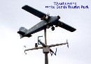 For
some unexplained reason, the Cricket match wasn�t being telecast in this neck
of the woods so we had to satisfy ourselves with the ABC radio commentary which
was intermittent with a lot of interference from the overhead power lines. For
some unexplained reason, the Cricket match wasn�t being telecast in this neck
of the woods so we had to satisfy ourselves with the ABC radio commentary which
was intermittent with a lot of interference from the overhead power lines.
 Grrrr�
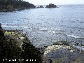
Not having any grandkids with us, we took our transistor radio out instead, for
a stroll along the beach of Wedge Bay, just a few short steps from the park but
the air smelt pretty foul, not unlike the air of Orford so we cut the beach
walk short and made our way back to Just Trip�n by road instead. We eventually
deduced the bad odour must be due to the seaweed and dead marine life that had
been washed ashore at high tide and then left high and dry to nicely rot away
when the tide is out. My MOTH then suggested that we go for a drive as the
afternoon was still young. Although somewhat puzzled, I went along with his
idea. Why was I puzzled? Well, it�s most unusual for the good man to willingly
run around disconnecting the power cord, wind down the TV antenna and so on
once we had settled anywhere for the day. I wasn�t exactly brimming with good
cheer either as I was so much looking forward to watching a bit of the cricket
telecast. Grrrr�
Not having any grandkids with us, we took our transistor radio out instead, for
a stroll along the beach of Wedge Bay, just a few short steps from the park but
the air smelt pretty foul, not unlike the air of Orford so we cut the beach
walk short and made our way back to Just Trip�n by road instead. We eventually
deduced the bad odour must be due to the seaweed and dead marine life that had
been washed ashore at high tide and then left high and dry to nicely rot away
when the tide is out. My MOTH then suggested that we go for a drive as the
afternoon was still young. Although somewhat puzzled, I went along with his
idea. Why was I puzzled? Well, it�s most unusual for the good man to willingly
run around disconnecting the power cord, wind down the TV antenna and so on
once we had settled anywhere for the day. I wasn�t exactly brimming with good
cheer either as I was so much looking forward to watching a bit of the cricket
telecast.
 As it turned out, unbeknownst to me, he had put on his thinking cap and planned
on giving me a little surprise. He was a man on a mission! He drove all the way
back to the Tasman Arch car park, some 36km (22 miles) away, to the mobile caf�
where he had seen some nice crays (lobsters) for sale when he bought our lunch.
As it turned out, unbeknownst to me, he had put on his thinking cap and planned
on giving me a little surprise. He was a man on a mission! He drove all the way
back to the Tasman Arch car park, some 36km (22 miles) away, to the mobile caf�
where he had seen some nice crays (lobsters) for sale when he bought our lunch.
 He bought the
biggest cray they had for sale and on the way back we stopped at the only
supermarket in Nubeena (the Aboriginal word for crayfish), a sleepy little
holiday/fishing village which despite its 'smallness', is the largest township
on the Tasman Peninsula, to get a bottle of Cognac Seafood Cocktail sauce and a
couple of individual serves Mixed Berry Cheesecake. By the time we got back to
the White Beach Tourist Park, the cricket live telecast was on so we both
chilled out with a nice cold drink and watched cricket till it ended for the
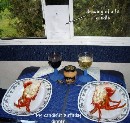
day. While I was having my shower, my MOTH got busy with cleaning the lobster
and had the table set with a glass of champagne for me and a picture of a lit
candle that he had hastily drawn and propped up against the window! Indeed I
was deeply touched by his sweet gesture. After dessert and coffee, he even did
the dishes and refused to let me touch the tea-towel� What a guy! He bought the
biggest cray they had for sale and on the way back we stopped at the only
supermarket in Nubeena (the Aboriginal word for crayfish), a sleepy little
holiday/fishing village which despite its 'smallness', is the largest township
on the Tasman Peninsula, to get a bottle of Cognac Seafood Cocktail sauce and a
couple of individual serves Mixed Berry Cheesecake. By the time we got back to
the White Beach Tourist Park, the cricket live telecast was on so we both
chilled out with a nice cold drink and watched cricket till it ended for the
day. While I was having my shower, my MOTH got busy with cleaning the lobster
and had the table set with a glass of champagne for me and a picture of a lit
candle that he had hastily drawn and propped up against the window! Indeed I
was deeply touched by his sweet gesture. After dessert and coffee, he even did
the dishes and refused to let me touch the tea-towel� What a guy!
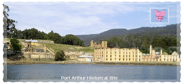
Day 9 Nov 20:
 We left the Tourist Park at 9am and headed straight for Port Arthur Historic
Site, getting
We left the Tourist Park at 9am and headed straight for Port Arthur Historic
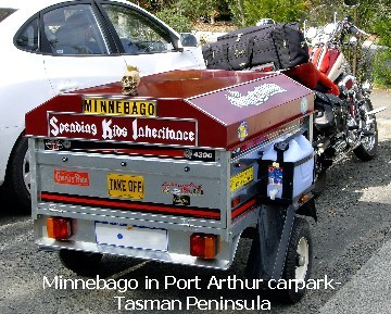
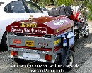
Site, getting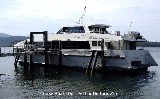 there about 9.30am. While walking to the site entrance, we spotted an unusual
vehicle in the car-park - a Yamaha motorcycle with a little trailer cutely
named "Minnebago", so out came our cameras to take our first photo of the day.
We then proceeded to the ticket counter to purchase two tickets (1 senior, 1
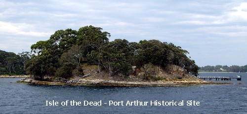
adult) as well as the additional tickets necessary for a tour of the Isle of
the Dead (originally called Opossum Island), bringing the total to $65. To kill
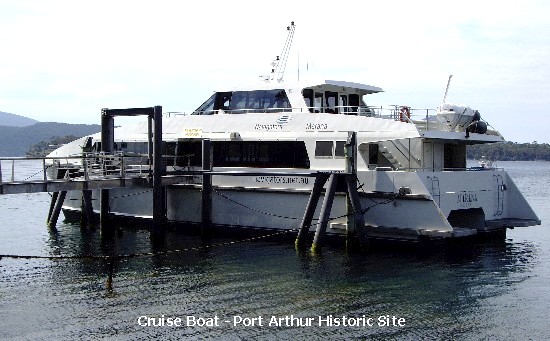
some time before the scheduled 11am harbour cruise, we sauntered around the
park until it was time to board the cruise boat. Those with the relevant
tickets like us, were dropped off at the jetty at the Isle of The Dead with a
guide leading the way for an interesting 40-minute tour of the historic
cemetery where about 1100 people were buried according to their
there about 9.30am. While walking to the site entrance, we spotted an unusual
vehicle in the car-park - a Yamaha motorcycle with a little trailer cutely
named "Minnebago", so out came our cameras to take our first photo of the day.
We then proceeded to the ticket counter to purchase two tickets (1 senior, 1
adult) as well as the additional tickets necessary for a tour of the Isle of
the Dead (originally called Opossum Island), bringing the total to $65. To kill
some time before the scheduled 11am harbour cruise, we sauntered around the
park until it was time to board the cruise boat. Those with the relevant
tickets like us, were dropped off at the jetty at the Isle of The Dead with a
guide leading the way for an interesting 40-minute tour of the historic
cemetery where about 1100 people were buried according to their
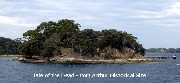 station
in life - the lower half of the island was reserved for convicts, lunatics,
invalids and paupers and the higher ground was reserved for civil and military
burials. station
in life - the lower half of the island was reserved for convicts, lunatics,
invalids and paupers and the higher ground was reserved for civil and military
burials.  We
were picked up by the cruise boat and brought back to the jetty at 12.15pm and
at 12.30pm, visitors were divided into two groups before being led off in
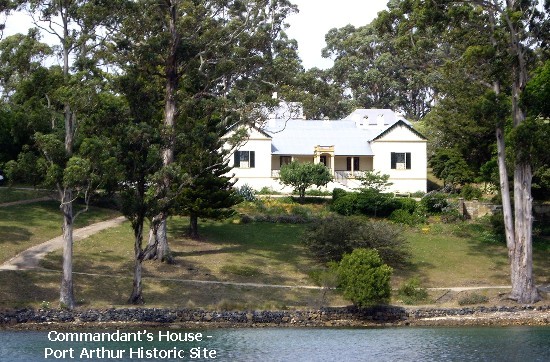
different directions for a short guided tour of the park. After that ended, we
were left to our own devises to explore the park to our hearts� desire. Man,
did we walk! Five and a half hours after our arrival, we both had enough of
walking from one site to another - from the Asylum to the gloomy solitary
confinement cells, from the Commandant's House right down to the Convict Church
ruins, so we decided to call it a day. We
were picked up by the cruise boat and brought back to the jetty at 12.15pm and
at 12.30pm, visitors were divided into two groups before being led off in
different directions for a short guided tour of the park. After that ended, we
were left to our own devises to explore the park to our hearts� desire. Man,
did we walk! Five and a half hours after our arrival, we both had enough of
walking from one site to another - from the Asylum to the gloomy solitary
confinement cells, from the Commandant's House right down to the Convict Church
ruins, so we decided to call it a day. 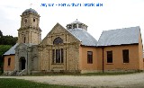 By
then, our legs felt like we had been dragging a ball and chain all day and we
could hardly wait to get back to the Tourist Park for another night�s stay. By
the time we got back to White Beach, the Cricket match was over so we missed
out on watching the Aussies beat the Sri Lankans by 96 runs. After a bit of a
rest, we did our laundry ($4 to use the washing machine and $3 to use the
dryer) and to save some time, we took turns to have a shower while the other
spent some exciting time watching our clothes tumbling around in the dryer.
Good to know that we won�t have to worry about dirty clothes for another week
now. Had dinner of Rendang and rice before settling in for a couple of hours of
TV viewing, finally succumbing to sleep before the midnight hour. Tomorrow we
will check out the Tasmanian Devil Park before heading south towards Hobart. By
then, our legs felt like we had been dragging a ball and chain all day and we
could hardly wait to get back to the Tourist Park for another night�s stay. By
the time we got back to White Beach, the Cricket match was over so we missed
out on watching the Aussies beat the Sri Lankans by 96 runs. After a bit of a
rest, we did our laundry ($4 to use the washing machine and $3 to use the
dryer) and to save some time, we took turns to have a shower while the other
spent some exciting time watching our clothes tumbling around in the dryer.
Good to know that we won�t have to worry about dirty clothes for another week
now. Had dinner of Rendang and rice before settling in for a couple of hours of
TV viewing, finally succumbing to sleep before the midnight hour. Tomorrow we
will check out the Tasmanian Devil Park before heading south towards Hobart.
Day 10 Nov 21:
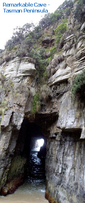
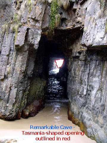
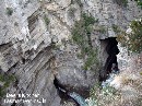
 We drove out of White Beach at 9am and headed towards Port Arthur to check out
Remarkable Cave (so called because if viewed from the correct angle, the mouth
of the cave is the same shape as Tasmania), a cave with two openings located at
Maingon Bay and accessible only via a steep and narrow set of stairs (someone
had obviously counted the number of stairs and wrote �116� on the info sign).
The crumpled concertina pattern on the outside of Remarkable Cave was created
by dolerite baked on crumpled sandstone as it cooled after being forced toward
the Earth's surface as molton rock. Several photos later, we left the area and
drove out of the Tasman Peninsula, back into Forestier Peninsula, only stopping
for a photo of a Tudor manor in the Tasmanian bush, the Fox and Hounds Inn.
We drove out of White Beach at 9am and headed towards Port Arthur to check out
Remarkable Cave (so called because if viewed from the correct angle, the mouth
of the cave is the same shape as Tasmania), a cave with two openings located at
Maingon Bay and accessible only via a steep and narrow set of stairs (someone
had obviously counted the number of stairs and wrote �116� on the info sign).
The crumpled concertina pattern on the outside of Remarkable Cave was created
by dolerite baked on crumpled sandstone as it cooled after being forced toward
the Earth's surface as molton rock. Several photos later, we left the area and
drove out of the Tasman Peninsula, back into Forestier Peninsula, only stopping
for a photo of a Tudor manor in the Tasmanian bush, the Fox and Hounds Inn.
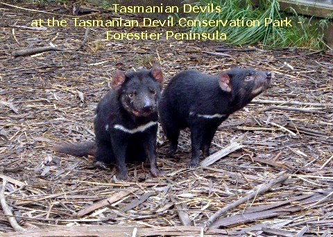
I wanted to see the Tasmanian Devils up close and personal so we went to the
Tasmanian Devil Conservation Park situated between Eaglehawk Neck and Dunalley.

 Entry cost $24pp and included in the entrance fee were viewing of Tasmanian
Devils being fed, Kings of the Wind Bird Show (free-flight raptor show) which
included the Dive of the Falcon where a falcon flew in from out of nowhere,
right between the legs of three volunteers who had been asked to stand with
their legs apart, one behind another, much to the amusement of the awestruck
spectators. Then there was the thieving white cockatoo who cheekily pinched coins from the hands
of visitors and deposited them into his keeper's pocket.
Entry cost $24pp and included in the entrance fee were viewing of Tasmanian
Devils being fed, Kings of the Wind Bird Show (free-flight raptor show) which
included the Dive of the Falcon where a falcon flew in from out of nowhere,
right between the legs of three volunteers who had been asked to stand with
their legs apart, one behind another, much to the amusement of the awestruck
spectators. Then there was the thieving white cockatoo who cheekily pinched coins from the hands
of visitors and deposited them into his keeper's pocket.
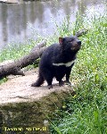 We
were introduced to tawny frogmouths which I first mistook to be owls and
several other interesting feathered creatures. We
were introduced to tawny frogmouths which I first mistook to be owls and
several other interesting feathered creatures.
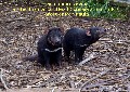 After the bird show, visitors were free to wander around the park so off we went with our cameras to see more
of our feathered friends - from beautiful budgerigars to pretty parrots, some
in enclosures and others like the Cape Baron Geese roamed freely all over the
place. We walked around a huge paddock that had countless kangaroos and
wallabies and it wasn't long before we got tired of playig the game, "dodge the
kangaroo poo", so we left the Conservation Park and headed off to Dunalley for
lunch of crumbed butterfish and chips from Dunalley Fish Market, washed down
with a drink of Coke. A few hundred meters up the road after leaving the Fish
Market, we began discussing our dinner plan for the evening � �Mmm, a crayfish
would be nice�� we mused simultaneously, so the MOTH made a slick U-turn to go
back to the Fish Market to buy one.
After the bird show, visitors were free to wander around the park so off we went with our cameras to see more
of our feathered friends - from beautiful budgerigars to pretty parrots, some
in enclosures and others like the Cape Baron Geese roamed freely all over the
place. We walked around a huge paddock that had countless kangaroos and
wallabies and it wasn't long before we got tired of playig the game, "dodge the
kangaroo poo", so we left the Conservation Park and headed off to Dunalley for
lunch of crumbed butterfish and chips from Dunalley Fish Market, washed down
with a drink of Coke. A few hundred meters up the road after leaving the Fish
Market, we began discussing our dinner plan for the evening � �Mmm, a crayfish
would be nice�� we mused simultaneously, so the MOTH made a slick U-turn to go
back to the Fish Market to buy one.
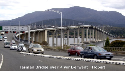
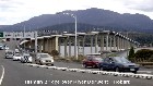 From Dunalley, we got onto the Tasman Highway and drove through Sorell to get
on the Tasman Bridge over the River Derwent into Hobart, and onto the Channel
Highway to Kingston where the MOTH replenished his cash supply at an ATM. We
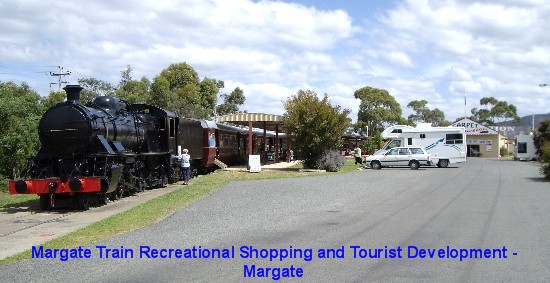
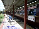
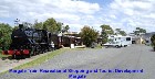
then drove on to Margate, where, in a siding beside the road, stood the last
passenger train to run in Tasmania. What a novel way of utilizing an old train!
The carriages had been cleverly converted into little shops - a pancake
parlour, coffee shop, souvenir stores, etc... a quaint shopping complex known
as Margate Train Recreational Shopping and Tourist Development.
From Dunalley, we got onto the Tasman Highway and drove through Sorell to get
on the Tasman Bridge over the River Derwent into Hobart, and onto the Channel
Highway to Kingston where the MOTH replenished his cash supply at an ATM. We
then drove on to Margate, where, in a siding beside the road, stood the last
passenger train to run in Tasmania. What a novel way of utilizing an old train!
The carriages had been cleverly converted into little shops - a pancake
parlour, coffee shop, souvenir stores, etc... a quaint shopping complex known
as Margate Train Recreational Shopping and Tourist Development.
 We stopped for
a bit of a sticky-beak before continuing our drive on the coastal road through
Snug (named because of its quiet and snug surroundings), We stopped for
a bit of a sticky-beak before continuing our drive on the coastal road through
Snug (named because of its quiet and snug surroundings),
 Kettering
(noted for orchards of apples, cherries, pears and also as a regional fishing
centre), Woodbridge (another coastal township noted for its orchards) and so
on, finally calling it a day at Cygnet, a small town 55km south-west of Hobart,
in the Huon Valley. We spent the night at the Cygnet Holiday Park, this place
being the most expensive, with a powered site costing $30 a night. It was just
as well the water supply in the park was potable as our supply of drinking
water had just about run out. We feasted on the crayfish purchased earlier
before a relaxing night in front of the TV. Tomorrow we�ll work our way down to
Southport, the southernmost part of Tasmania that is accessible by bitumen
road. Kettering
(noted for orchards of apples, cherries, pears and also as a regional fishing
centre), Woodbridge (another coastal township noted for its orchards) and so
on, finally calling it a day at Cygnet, a small town 55km south-west of Hobart,
in the Huon Valley. We spent the night at the Cygnet Holiday Park, this place
being the most expensive, with a powered site costing $30 a night. It was just
as well the water supply in the park was potable as our supply of drinking
water had just about run out. We feasted on the crayfish purchased earlier
before a relaxing night in front of the TV. Tomorrow we�ll work our way down to
Southport, the southernmost part of Tasmania that is accessible by bitumen
road.
Day 11 Nov 22:
 We pulled out of Cygnet at 9am after �selling� the amenities key back to the
caretaker for $30 to recoup the deposit we handed him the evening before. We
drove up the road a little way to one of the two petrol stations in town to top
up on diesel then it was off to Hounville (a town on the Huon River in the Huon
Valley best known as one of Tasmania�s primary apple growing areas) to get on
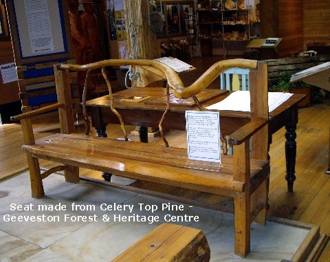
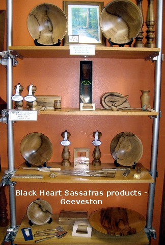
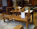
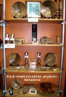
the Huon Highway. A stop was made at Geeveston Forest and Heritage Centre for a
little tour of the Centre with its interesting display of furniture and various
works of art carved from Tasmanian timber. (Geeveston is a small timber and
apple growing town in the Huon Valley.)
We pulled out of Cygnet at 9am after �selling� the amenities key back to the
caretaker for $30 to recoup the deposit we handed him the evening before. We
drove up the road a little way to one of the two petrol stations in town to top
up on diesel then it was off to Hounville (a town on the Huon River in the Huon
Valley best known as one of Tasmania�s primary apple growing areas) to get on
the Huon Highway. A stop was made at Geeveston Forest and Heritage Centre for a
little tour of the Centre with its interesting display of furniture and various
works of art carved from Tasmanian timber. (Geeveston is a small timber and
apple growing town in the Huon Valley.)  My
MOTH bought me a ruler - no, not to measure the distance we�ll be travelling,
but a souvenir ruler made with sample bits of various Tasmanian timber. We also
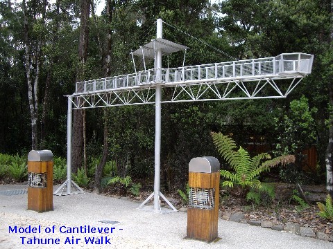
purchased tickets ($22pp) to enter the Tahune Forest AirWalk and with the 10%
discount coupon attached, we stocked up on groceries from the local IGA
supermarket across the road. From there, we had a half-hour 28km (17.4 miles)
drive on yet another winding road to get to the Tahune Forest AirWalk. [Tahune
is an aboriginal word meaning, "peaceful place by running water", the running
water being the Huon River.] My
MOTH bought me a ruler - no, not to measure the distance we�ll be travelling,
but a souvenir ruler made with sample bits of various Tasmanian timber. We also
purchased tickets ($22pp) to enter the Tahune Forest AirWalk and with the 10%
discount coupon attached, we stocked up on groceries from the local IGA
supermarket across the road. From there, we had a half-hour 28km (17.4 miles)
drive on yet another winding road to get to the Tahune Forest AirWalk. [Tahune
is an aboriginal word meaning, "peaceful place by running water", the running
water being the Huon River.]
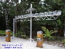
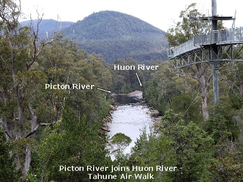
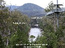 It was an awesome experience tackling the super high 597m (1959ft) AirWalk, the
highlight being the walk on the 24m (almost 79ft) long cantilever, 48m
(157.5ft) above the Huon River. It swayed like a springboard as I nervously
walked on it but I was rewarded with fantastic views of the forest canopy and
the confluence of the Huon and Picton Rivers with what I believe to be Mt
Picton in the background. My MOTH refused to walk on this cantilever and
satisfied himself with a photo of me when I got to the very end. With adrenalin
still pumping, I readily agreed to go on the 3km Swinging Bridges Circuit one
hour walk to cross two swinging bridges, the first one over the Huon River and
the second over the Picton River. I found crossing the swinging bridges to be
rather daunting but refused to succumb to my trepidation and battled on. I felt
a great sense of achievement after my successful swinging bridges crossings and
was quite proud of myself. I celebrated with a drink of Coke Zero that I had
with me when we reached the last leg of the walk. One minute I was striding
along, happy to see the roof of the entrance from the last little hill and next
thing I knew, I slipped on the loose gravel, took a downhill dive and landed on
my right knee. Man! That was so not fun! Luckily, my camera didn�t hit the
ground and I didn�t spill a single drop of my can of drink� lucky too, that I
didn�t tear the right knee of my jeans. With my MOTH�s assistance, I hobbled
gingerly over to a nearby bench and surveyed my bloodied knee. I mopped up the
blood with some tissues and continued on to the entrance, being careful not to
get too much blood on my jeans. We decided against the 30-minute return Huon
Trail walk and made our way back to Just Trip�n instead. Some Neosporin� on my
injured knee, a Band-Aid� over it and I was almost good to go.
It was an awesome experience tackling the super high 597m (1959ft) AirWalk, the
highlight being the walk on the 24m (almost 79ft) long cantilever, 48m
(157.5ft) above the Huon River. It swayed like a springboard as I nervously
walked on it but I was rewarded with fantastic views of the forest canopy and
the confluence of the Huon and Picton Rivers with what I believe to be Mt
Picton in the background. My MOTH refused to walk on this cantilever and
satisfied himself with a photo of me when I got to the very end. With adrenalin
still pumping, I readily agreed to go on the 3km Swinging Bridges Circuit one
hour walk to cross two swinging bridges, the first one over the Huon River and
the second over the Picton River. I found crossing the swinging bridges to be
rather daunting but refused to succumb to my trepidation and battled on. I felt
a great sense of achievement after my successful swinging bridges crossings and
was quite proud of myself. I celebrated with a drink of Coke Zero that I had
with me when we reached the last leg of the walk. One minute I was striding
along, happy to see the roof of the entrance from the last little hill and next
thing I knew, I slipped on the loose gravel, took a downhill dive and landed on
my right knee. Man! That was so not fun! Luckily, my camera didn�t hit the
ground and I didn�t spill a single drop of my can of drink� lucky too, that I
didn�t tear the right knee of my jeans. With my MOTH�s assistance, I hobbled
gingerly over to a nearby bench and surveyed my bloodied knee. I mopped up the
blood with some tissues and continued on to the entrance, being careful not to
get too much blood on my jeans. We decided against the 30-minute return Huon
Trail walk and made our way back to Just Trip�n instead. Some Neosporin� on my
injured knee, a Band-Aid� over it and I was almost good to go.
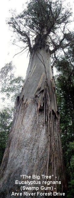
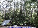
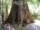
 On the way back to Geeveston, on the Arve River Forest Drive, we stopped at the
West Creek Lookout for a couple of photos of more trees and treetops and
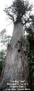
further along, at the Big Tree Lookout, to admire a humongous tree which
according to scientific calculations is the biggest, i.e. heaviest tree in
Australia, 87m (285.5ft) high and weighing 405 tonnes (446.5 tons). The Big
Tree is a Eucalyptus regnans (Regnans means regal) also called a Swamp Gum, the
sole survivor of the fires of 1914, 1934 and 1967 and others that had burnt off
all the original limbs. Even though the top had blown out and it is dying, it
is still regal and magnificent and given the title of �Queen without a crown�
by Steve Davis, a forester with 32 years experience in Forestry.
On the way back to Geeveston, on the Arve River Forest Drive, we stopped at the
West Creek Lookout for a couple of photos of more trees and treetops and
further along, at the Big Tree Lookout, to admire a humongous tree which
according to scientific calculations is the biggest, i.e. heaviest tree in
Australia, 87m (285.5ft) high and weighing 405 tonnes (446.5 tons). The Big
Tree is a Eucalyptus regnans (Regnans means regal) also called a Swamp Gum, the
sole survivor of the fires of 1914, 1934 and 1967 and others that had burnt off
all the original limbs. Even though the top had blown out and it is dying, it
is still regal and magnificent and given the title of �Queen without a crown�
by Steve Davis, a forester with 32 years experience in Forestry.
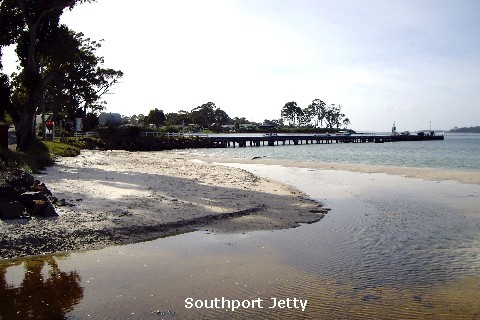
 From there it was back on the Huon Highway, heading south to Southport, the
southernmost town accessible by bitumen road. Originally named Bay of Moules by
French explorers and Mussel Bay by the English, Southport was founded on Feb
16, 1864 and was the first convict settlement in the Huon region. The region�s
local industries are mainly apple-growing, timber and fishing. We spent the
night at the Southport Settlement Caravan Park at the CMCA discounted fee of
$18 a night for a powered site. I cooked fried rice with leftover roast lamb
for our dinner. There had been no contact with our kids all day as there was no
mobile phone signal and TV reception was pretty woeful - only one channel with
cartoon shows for kids, so we ended up watching a couple of movies on DVDs
instead.
From there it was back on the Huon Highway, heading south to Southport, the
southernmost town accessible by bitumen road. Originally named Bay of Moules by
French explorers and Mussel Bay by the English, Southport was founded on Feb
16, 1864 and was the first convict settlement in the Huon region. The region�s
local industries are mainly apple-growing, timber and fishing. We spent the
night at the Southport Settlement Caravan Park at the CMCA discounted fee of
$18 a night for a powered site. I cooked fried rice with leftover roast lamb
for our dinner. There had been no contact with our kids all day as there was no
mobile phone signal and TV reception was pretty woeful - only one channel with
cartoon shows for kids, so we ended up watching a couple of movies on DVDs
instead.
Day 12 Nov 23:
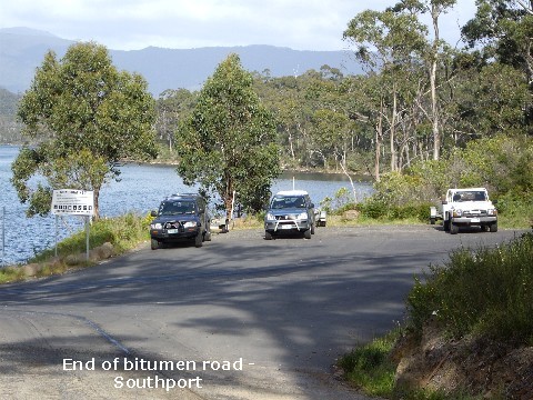
 A few minutes after 8am, we left the Southport Settlement Caravan Park (the
southernmost Caravan Park in Tasmania) and drove to the very end of Kingfisher
Beach Road (the end of the bitumen road), the site of the prison governor�s
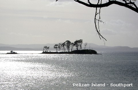
house and cell blocks and also the site of the first hotel. I took a photo of
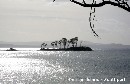
Pelican Island (at one time used as a burial ground for the victims of a local
diphtheria epidemic) before we left Southport to drive to Hastings.
A few minutes after 8am, we left the Southport Settlement Caravan Park (the
southernmost Caravan Park in Tasmania) and drove to the very end of Kingfisher
Beach Road (the end of the bitumen road), the site of the prison governor�s
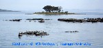
house and cell blocks and also the site of the first hotel. I took a photo of
Pelican Island (at one time used as a burial ground for the victims of a local
diphtheria epidemic) before we left Southport to drive to Hastings.
 Eventually we found our way to Hastings Visitor Centre where we purchased
tickets to the Hastings Caves State Reserve. Entry cost $22 per person and
included a guided tour of Newdegate Cave and full use of the amenities at
Hastings Thermal Springs. I nudged my MOTH to fish out his Seniors Card and as
a result, he only paid the Senior discounted fee of $17.60. I must have looked
older than my years that day as I was also given the Senior�s discount! No
complaints from this old chook though, that�s for sure�
Eventually we found our way to Hastings Visitor Centre where we purchased
tickets to the Hastings Caves State Reserve. Entry cost $22 per person and
included a guided tour of Newdegate Cave and full use of the amenities at
Hastings Thermal Springs. I nudged my MOTH to fish out his Seniors Card and as
a result, he only paid the Senior discounted fee of $17.60. I must have looked
older than my years that day as I was also given the Senior�s discount! No
complaints from this old chook though, that�s for sure�
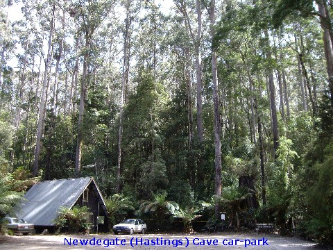
 Never having had the experience of a cave tour before, my excitement mounted as
we drove along 5km (3 miles) of gravel road to the cave site and as we were way
too early for the scheduled 10.15am tour, we decided to enjoy a brunch of sweet
chili tuna spread sandwiches in the car-park before the 5 minute downhill walk
to the tour rendezvous point at the entrance of Newdegate Cave. The Hastings
Caves started forming some 40 million years ago and remained undiscovered until
a group of timber workers stumbled upon the entrance in 1917.
Never having had the experience of a cave tour before, my excitement mounted as
we drove along 5km (3 miles) of gravel road to the cave site and as we were way
too early for the scheduled 10.15am tour, we decided to enjoy a brunch of sweet
chili tuna spread sandwiches in the car-park before the 5 minute downhill walk
to the tour rendezvous point at the entrance of Newdegate Cave. The Hastings
Caves started forming some 40 million years ago and remained undiscovered until
a group of timber workers stumbled upon the entrance in 1917.
 Newdegate
Cave is one of only two dolomite caves in Australia and is the largest tourist
cave in the country. [The other is on mainland Australia, the Tantanoola Cave
near Millicent in South Australia.] It is named after the governor of the time,
Sir Francis Newdegate and was officially opened on January 19th,
1939. Newdegate
Cave is one of only two dolomite caves in Australia and is the largest tourist
cave in the country. [The other is on mainland Australia, the Tantanoola Cave
near Millicent in South Australia.] It is named after the governor of the time,
Sir Francis Newdegate and was officially opened on January 19th,
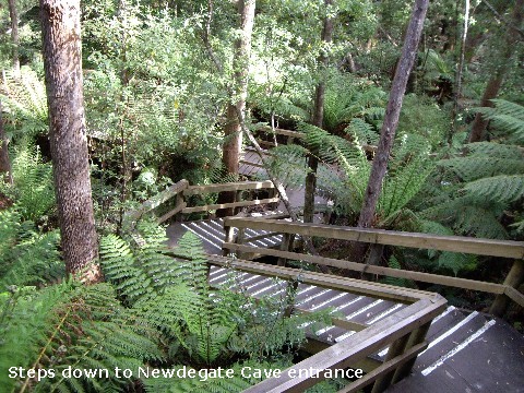
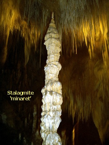
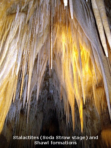
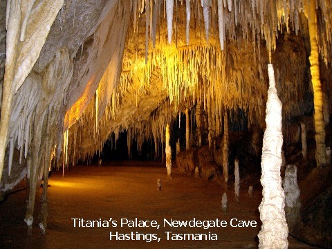
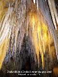
1939. 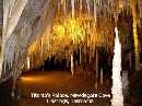 We enjoyed a 45-minute guided tour of the massive cave filled with spectacular
formations of flowstone, stalactites, columns, shawls, straws, stalagmites and
rare helictites with the underground temperature naturally maintained at 9o
Celsius. The last part of the tour was awesome - we were shown Titania's Palace
- a spectacular wonderland of stalagmites and stalactites which has earned
Newdegate Cave a reputation as one of the most beautiful caves in the country.
Altogether, we negotiated 245 stairs before we saw daylight again.
We enjoyed a 45-minute guided tour of the massive cave filled with spectacular
formations of flowstone, stalactites, columns, shawls, straws, stalagmites and
rare helictites with the underground temperature naturally maintained at 9o
Celsius. The last part of the tour was awesome - we were shown Titania's Palace
- a spectacular wonderland of stalagmites and stalactites which has earned
Newdegate Cave a reputation as one of the most beautiful caves in the country.
Altogether, we negotiated 245 stairs before we saw daylight again.
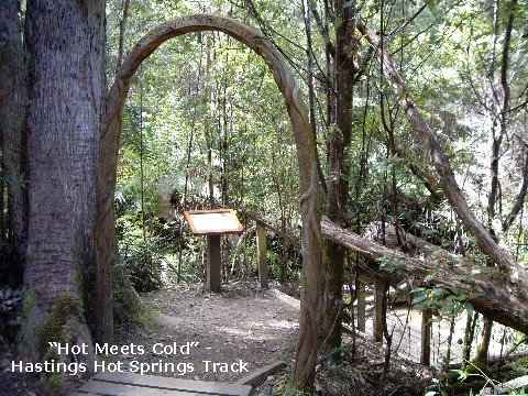
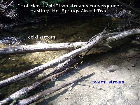
 After the cave tour, it was back to the Hastings Visitor Centre for the 100mtrs
(110yds) forest walk along the Hot Springs Track. When we got to the "Hot Meets
Cold" information archway marking the convergence of two streams, we put our
hands in the water to feel the warm current from one stream meeting with the
cold current from the other. The warm spring water is alkaline, clear, with a
bluish tinge and only slightly mineralised whilst the cold water is acidic and "tea"
coloured from natural tannins.
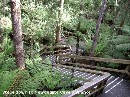
Both streams are pollution-free. We continued strolling along the designated walkway
through the forest,
After the cave tour, it was back to the Hastings Visitor Centre for the 100mtrs
(110yds) forest walk along the Hot Springs Track. When we got to the "Hot Meets
Cold" information archway marking the convergence of two streams, we put our
hands in the water to feel the warm current from one stream meeting with the
cold current from the other. The warm spring water is alkaline, clear, with a
bluish tinge and only slightly mineralised whilst the cold water is acidic and "tea"
coloured from natural tannins.
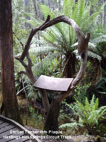
Both streams are pollution-free. We continued strolling along the designated walkway
through the forest,
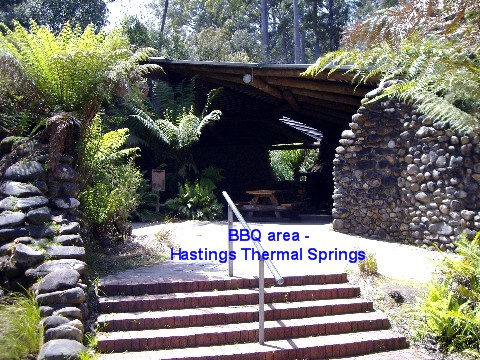
 stopping now and again to read the various informative plaques, some cleverly etched into timber.
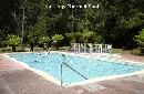
At the end of our walk, we admired
the surrounds of the Thermal Springs Pool (constant temperature of 27o
Celsius) which is set in bushland with modern picnic facilities in a
picturesque BBQ area. What a pity we didn't have our swimming gear with us...
It is believed that the Hastings Thermal Springs
is a karst water system that may be linked to that at Newdegate Cave. From
Hastings, it was another winding road drive over hills and vales on the Huon
stopping now and again to read the various informative plaques, some cleverly etched into timber.
At the end of our walk, we admired
the surrounds of the Thermal Springs Pool (constant temperature of 27o
Celsius) which is set in bushland with modern picnic facilities in a
picturesque BBQ area. What a pity we didn't have our swimming gear with us...
It is believed that the Hastings Thermal Springs
is a karst water system that may be linked to that at Newdegate Cave. From
Hastings, it was another winding road drive over hills and vales on the Huon Highway through Dover, Glendevie, Geeveston and various townships stopping at
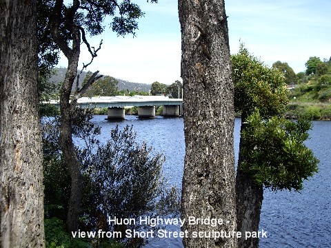
Franklin to utilize the grey water dumping station. Then it was on to Huonville
to check out the Wood Cutter sculpture on the bank of the Huon River as
mentioned in the sheet of visitor guide I was clutching. Only problem being the
absence of a town map of Huonville to guide us...
Highway through Dover, Glendevie, Geeveston and various townships stopping at
Franklin to utilize the grey water dumping station. Then it was on to Huonville
to check out the Wood Cutter sculpture on the bank of the Huon River as
mentioned in the sheet of visitor guide I was clutching. Only problem being the
absence of a town map of Huonville to guide us...
 Originally, the land on which Huonville is now located was privately owned and
it wasn't until 1889 that the town became known as Huonville. The town is
Originally, the land on which Huonville is now located was privately owned and
it wasn't until 1889 that the town became known as Huonville. The town is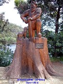 situated on fairly flat land a couple of metres above the mean level of the
Huon River. Every decade or two the river rises and floods part of the town.
The locals then cover up the road signs declaring the place to be "Huonville"
and replace them with the word "Venice" until the water subsides again. The
construction of the first timber bridge over the Huon River in 1876 cost �4400
- it was a toll bridge charging 2 pence for walkers and 6 pence for horses. The
original timber bridge was replaced in 1926 and the present steel and concrete
structure was completed in 1959. In the old days, the town was nothing more
than the Picnic Hotel and a couple of shops along the river. The Picnic Hotel
burnt down and was subsequently rebuilt as the Grand Hotel which still stands
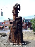
near the bridge. [It is in the background of the photo of the soldier wood
sculpture.]
situated on fairly flat land a couple of metres above the mean level of the
Huon River. Every decade or two the river rises and floods part of the town.
The locals then cover up the road signs declaring the place to be "Huonville"
and replace them with the word "Venice" until the water subsides again. The
construction of the first timber bridge over the Huon River in 1876 cost �4400
- it was a toll bridge charging 2 pence for walkers and 6 pence for horses. The
original timber bridge was replaced in 1926 and the present steel and concrete
structure was completed in 1959. In the old days, the town was nothing more
than the Picnic Hotel and a couple of shops along the river. The Picnic Hotel
burnt down and was subsequently rebuilt as the Grand Hotel which still stands
near the bridge. [It is in the background of the photo of the soldier wood
sculpture.]
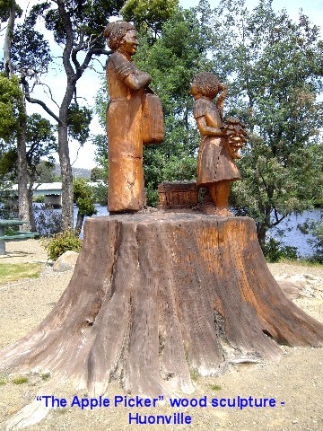
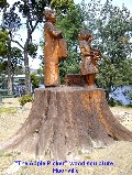
While my MOTH drove as slowly as he could, traffic permitting, my eyes darted
 all over the place desperately looking for the wood sculpture. I eventually
spotted it, along with a couple of other sculptures, just as we were on the
verge of giving up.
all over the place desperately looking for the wood sculpture. I eventually
spotted it, along with a couple of other sculptures, just as we were on the
verge of giving up.  There
they stood in Short Street, just over the Huon Highway bridge! I gleefully
leapt out of Just Trip'n to take a few photos while my MOTH waited patiently
behind the wheel. The Short Family had planted trees in 1902 to commemorate the
local volunteers and one hundred years later, at the end of the safe life of
the trees, the figures were sculptured from the stumps of the trees to maintain
the historic links. Sculpture of "The Wood Cutter" depicts a typical Huon
pioneer of the 1800s, "The Apple Picker" is dedicated to the women pioneers of
the Huon Valley and the sculpture of a soldier commemorates the local men who
volunteered for service in the Boer War. There
they stood in Short Street, just over the Huon Highway bridge! I gleefully
leapt out of Just Trip'n to take a few photos while my MOTH waited patiently
behind the wheel. The Short Family had planted trees in 1902 to commemorate the
local volunteers and one hundred years later, at the end of the safe life of
the trees, the figures were sculptured from the stumps of the trees to maintain
the historic links. Sculpture of "The Wood Cutter" depicts a typical Huon
pioneer of the 1800s, "The Apple Picker" is dedicated to the women pioneers of
the Huon Valley and the sculpture of a soldier commemorates the local men who
volunteered for service in the Boer War.
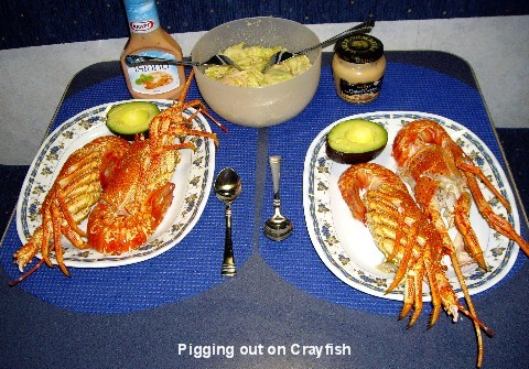
 From Huonville, we went on the Channel Highway to drive through Cygnet and
Oyster Cove before stopping at the seaside town of Snug to indulge in possibly
the last feed of fresh Tasmanian Crays as we would be leaving the coastline
tomorrow and heading inland, through the centre of the island. We decided to
really pig out by getting a full cray each. Our next stop was Meredith Fruit
Barn in Margate to get a couple of avocados, a few pears and several mandarins
before driving through Hobart on the Brooker Highway to get to New Norfolk to
spend the night at the New Norfolk Esplanade Caravan Park, situated close to
the Derwent River (Celtic meaning 'Clear Water') at $20 a night.
From Huonville, we went on the Channel Highway to drive through Cygnet and
Oyster Cove before stopping at the seaside town of Snug to indulge in possibly
the last feed of fresh Tasmanian Crays as we would be leaving the coastline
tomorrow and heading inland, through the centre of the island. We decided to
really pig out by getting a full cray each. Our next stop was Meredith Fruit
Barn in Margate to get a couple of avocados, a few pears and several mandarins
before driving through Hobart on the Brooker Highway to get to New Norfolk to
spend the night at the New Norfolk Esplanade Caravan Park, situated close to
the Derwent River (Celtic meaning 'Clear Water') at $20 a night.
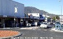
 New Norfolk is one of the oldest towns in Australia, originally called
Elizabeth Town and re-named by the settlers from Norfolk Island in 1807 when
the island's prison was closed down. It is the centre of the hop-growing area
which has produced hops for over a century and supplies the majority of the
hops used in the production of Tasmanian beer. By this stage of our trip, we
had developed a taste for Maille� Cognac Seafood Cocktail Sauce which enhanced
the flavour of the crays we had eaten recently and with very little left to
enjoy with the crays we had bought, we decided to go for a �short� walk UPHILL
to get to the town centre in search of a supermarket to get another jar of the
sauce. We walked for what seemed like hours as we had misread the visitors'
town map and overshot the street leading to the town centre, so we had to
back-pedal a block and a half. Found the only supermarket in the town centre
but alas, we came out empty-handed� At least the walk back was much more
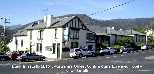
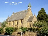
pleasant as it was all downhill, passing the Bush Inn, St Peters Catholic
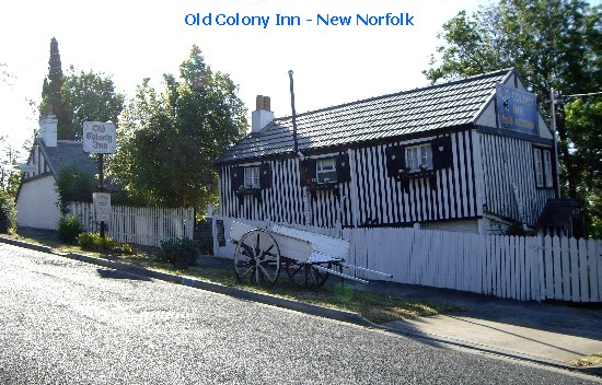
Church and the Old Colony Inn.
New Norfolk is one of the oldest towns in Australia, originally called
Elizabeth Town and re-named by the settlers from Norfolk Island in 1807 when
the island's prison was closed down. It is the centre of the hop-growing area
which has produced hops for over a century and supplies the majority of the
hops used in the production of Tasmanian beer. By this stage of our trip, we
had developed a taste for Maille� Cognac Seafood Cocktail Sauce which enhanced
the flavour of the crays we had eaten recently and with very little left to
enjoy with the crays we had bought, we decided to go for a �short� walk UPHILL
to get to the town centre in search of a supermarket to get another jar of the
sauce. We walked for what seemed like hours as we had misread the visitors'
town map and overshot the street leading to the town centre, so we had to
back-pedal a block and a half. Found the only supermarket in the town centre
but alas, we came out empty-handed� At least the walk back was much more
pleasant as it was all downhill, passing the Bush Inn, St Peters Catholic
Church and the Old Colony Inn.
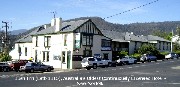 The Bush Inn was built by one of the area's early enterprising women, Ann
Bridger and mentioned in the 1985 Guiness Book of Records as the oldest
continuously licensed hotel in Australia. St. Peter's Catholic Church is an old
stone building boasting a magnificent spire against the backdrop of the Derwent
hills.
The Bush Inn was built by one of the area's early enterprising women, Ann
Bridger and mentioned in the 1985 Guiness Book of Records as the oldest
continuously licensed hotel in Australia. St. Peter's Catholic Church is an old
stone building boasting a magnificent spire against the backdrop of the Derwent
hills.  Then
we came to the historic Old Colony Inn which started out as a hop shed in 1815
and later extended with a mud and stone lower floor and a convict brick upper
floor to become a private dwelling. Over the years, the building has served as
a school, gymnasium and barracks, until 1940 when William Rees, an antique
dealer and artist, bought the property and developed it into The Old Colony Inn
of today. By the time we got back to Just Trip'n, we were more than ready for a
refreshing shower before sitting down to feast on our crays with half an
avocado apiece and a side of tossed salad. We were both too full for dessert
and today�s activities had tired us both out to the point where we actually
looked forward to an early night� Then
we came to the historic Old Colony Inn which started out as a hop shed in 1815
and later extended with a mud and stone lower floor and a convict brick upper
floor to become a private dwelling. Over the years, the building has served as
a school, gymnasium and barracks, until 1940 when William Rees, an antique
dealer and artist, bought the property and developed it into The Old Colony Inn
of today. By the time we got back to Just Trip'n, we were more than ready for a
refreshing shower before sitting down to feast on our crays with half an
avocado apiece and a side of tossed salad. We were both too full for dessert
and today�s activities had tired us both out to the point where we actually
looked forward to an early night�
OzLadyM
   
Border: BoogieJack
Copyright � 2008
OzLadyM
Please do not use any material on this website without my permission. Thank
you.
|