| |
 TASMANIA, AUSTRALIA'S APPLE ISLE - Nov 2007
(Part 1)
 Tasmania
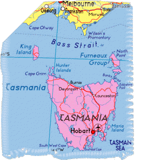
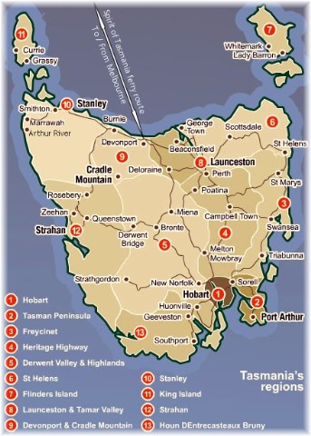
is Australia�s Apple Isle � our historic island state with rugged mountains,
magnificent lakes, beaches, rivers, waterfalls and quaint townships with plenty
of history, originally named Van Diemen�s Land (1803 � 1856) by early
Europeans. I�ve always wanted to visit this idyllic island so my M.O.T.H. (Man
Of The House) decided to make my wish come true as his birthday gift to me this
year. He made the necessary bookings for a return trip for us to take our
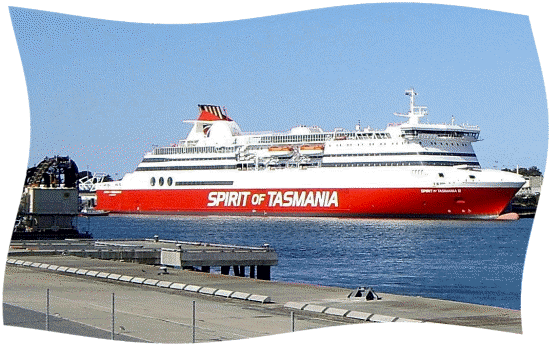
motor-home (Just Trip'n) on the passenger and vehicular ferry, 'Spirit of
Tasmania'. We had an early celebratory family lunch at Cho Gao, a Korean
restaurant in Melbourne Central on Sunday (the day before our departure) before
a bit of a flutter at the Casino afterwards to use up my $40 complimentary
voucher. We didn�t win so we came home early to finish some last minute
packing, with mounting excitement at the thought of the adventure ahead. Tasmania
is Australia�s Apple Isle � our historic island state with rugged mountains,
magnificent lakes, beaches, rivers, waterfalls and quaint townships with plenty
of history, originally named Van Diemen�s Land (1803 � 1856) by early
Europeans. I�ve always wanted to visit this idyllic island so my M.O.T.H. (Man
Of The House) decided to make my wish come true as his birthday gift to me this
year. He made the necessary bookings for a return trip for us to take our
motor-home (Just Trip'n) on the passenger and vehicular ferry, 'Spirit of
Tasmania'. We had an early celebratory family lunch at Cho Gao, a Korean
restaurant in Melbourne Central on Sunday (the day before our departure) before
a bit of a flutter at the Casino afterwards to use up my $40 complimentary
voucher. We didn�t win so we came home early to finish some last minute
packing, with mounting excitement at the thought of the adventure ahead.
Day 1 Nov 12:
 After completing various pre-travel chores and a quick bite of lunch at Macca�s
(McDonalds) we stocked up the freezer of �Just Trip'n� with various frozen
meals that I had pre-cooked the week before. My MOTH, not wanting to spoil our
holiday with me falling off the perch, made sure that I had enough supply of my
prescribed medication as well as the travel-sickness pills that his sister had
strongly recommended, in case we encountered rough weather during the 11-hour
oceangoing ferry ride across Bass Strait. This was followed by a super-early
dinner before we eagerly set off for Station Pier at Port Melbourne to board
the Spirit of Tasmania, arriving there at 5.20pm.
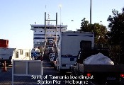 We
joined in the loading queue with a gazillion fellow-travelers in various modes
of transportation - campervans, caravans, farm trucks, mini buses, motor-homes,
all makes and models of motor-cars and 4WDs, vintage cars, etc., and what
seemed like at least half the members of Hell�s Angels - from all corners of
mainland Australia. Went through the routine security checks and then they
tested our patience with the long, long wait before the loading process began.
As we patiently waited, we scoffed down a bagful of home grown cherries. We
joined in the loading queue with a gazillion fellow-travelers in various modes
of transportation - campervans, caravans, farm trucks, mini buses, motor-homes,
all makes and models of motor-cars and 4WDs, vintage cars, etc., and what
seemed like at least half the members of Hell�s Angels - from all corners of
mainland Australia. Went through the routine security checks and then they
tested our patience with the long, long wait before the loading process began.
As we patiently waited, we scoffed down a bagful of home grown cherries.
 By
7.15pm, loading smoothly completed, we made our way to our allocated ocean view
recliners on Deck 8 and to kill time before the scheduled 8pm departure, we
went for a little walkabout on Deck 7, the main hive of activity on board. I
bought a souvenir fridge magnet for my collection while my ever-practical MOTH
bought a multi-entry pass for the National Parks. On the way back to Deck 8, we
happened to stray into the Admiral's Gaming Lounge... Much to my surprise, my
MOTH dipped his hand into his tight pocket, pulled out a $5 note, fed it into a
poker machine and told me, �Go on! Then you can say that you�ve played the
pokies on the �Spirit�!� Before I could open my mouth to thank him, he barked,
�That�s it though, we�re not staying here all night!� Needless to say, I
quickly punched a few buttons and within minutes, we headed back to Deck 8 with
a pocketful of $1 coins - 25 of them, to be exact. We both got our respective
iPods happening and comfortably settled into our recliners listening to songs
while feeding our faces with Zigzag Twisties�. It was a fairly
smooth ride except for a slightly bumpy session in the middle of Bass Strait
but certainly not enough to bring about a chundering performance from me. As
luck would have it, my watch strap decided to literally have a break so I was
watch-less for the rest of the ride. By
7.15pm, loading smoothly completed, we made our way to our allocated ocean view
recliners on Deck 8 and to kill time before the scheduled 8pm departure, we
went for a little walkabout on Deck 7, the main hive of activity on board. I
bought a souvenir fridge magnet for my collection while my ever-practical MOTH
bought a multi-entry pass for the National Parks. On the way back to Deck 8, we
happened to stray into the Admiral's Gaming Lounge... Much to my surprise, my
MOTH dipped his hand into his tight pocket, pulled out a $5 note, fed it into a
poker machine and told me, �Go on! Then you can say that you�ve played the
pokies on the �Spirit�!� Before I could open my mouth to thank him, he barked,
�That�s it though, we�re not staying here all night!� Needless to say, I
quickly punched a few buttons and within minutes, we headed back to Deck 8 with
a pocketful of $1 coins - 25 of them, to be exact. We both got our respective
iPods happening and comfortably settled into our recliners listening to songs
while feeding our faces with Zigzag Twisties�. It was a fairly
smooth ride except for a slightly bumpy session in the middle of Bass Strait
but certainly not enough to bring about a chundering performance from me. As
luck would have it, my watch strap decided to literally have a break so I was
watch-less for the rest of the ride.
Day 2 Nov 13:
 The �Spirit� docked at Devonport, a major regional centre in north-west
Tasmania, situated at the mouth of the Mersey River, at the scheduled time of
7am and we went through another more rigorous security check at the quarantine
station. There seemed to be at least half a million diligent quarantine
officers and their highly trained dogs checking on all vehicles in compliance
with the Tasmanian strict quarantine law against bringing flowers, fresh fruit
and vegetables into the island.
 As
soon as we were cleared through the quarantine station, my MOTH made a bee-line
for the city centre as his main priority was to buy me a watch so I wouldn�t
keep looking at the invisible one on my wrist. We drove over Victoria Bridge to
get to the CBD and very quickly located a car park, only to discover that we
had to pay for the privilege of parking there - $1 for an hour. My $1 coins
from the pokies win thus came in very handy. Not knowing our way about town, we
stopped to ask a council worker for directions to the nearest K-Mart, to be
told it was situated �a couple of blocks up the road - you can�t miss it!� Off
we set on foot and we walked and we walked and we walked� We finally got to the
car-park but of course it was way too early for businesses to start the day's
trading so instead of cooling our heels at the entrance of the shopping centre,
we decided to walk back to Just Trip'n and bring her around to the free
car-park at the shopping centre. As to be expected, no 'el cheapo' watch caught
my eye so we temporarily gave up on the watch purchase and bought essential
groceries from Woolworths instead. As
soon as we were cleared through the quarantine station, my MOTH made a bee-line
for the city centre as his main priority was to buy me a watch so I wouldn�t
keep looking at the invisible one on my wrist. We drove over Victoria Bridge to
get to the CBD and very quickly located a car park, only to discover that we
had to pay for the privilege of parking there - $1 for an hour. My $1 coins
from the pokies win thus came in very handy. Not knowing our way about town, we
stopped to ask a council worker for directions to the nearest K-Mart, to be
told it was situated �a couple of blocks up the road - you can�t miss it!� Off
we set on foot and we walked and we walked and we walked� We finally got to the
car-park but of course it was way too early for businesses to start the day's
trading so instead of cooling our heels at the entrance of the shopping centre,
we decided to walk back to Just Trip'n and bring her around to the free
car-park at the shopping centre. As to be expected, no 'el cheapo' watch caught
my eye so we temporarily gave up on the watch purchase and bought essential
groceries from Woolworths instead. 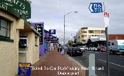 We
then drove around looking for a shopping mall and spied one not far from the
original council car park, so there goes another of my $1 coins� We walked for
what felt like hours desperately looking for a jewellery store, without any
success. Just as I became convinced that Tasmanians aren�t into jewellery, we
came across a jewellery store in the Rooke Street Mall where I found an
affordable watch I liked and a rather relieved MOTH gladly paid for it. By this
time, my MOTH was busting his guts to attend to his morning devotional so we
did a quick lap of the Mall before spotting the �Toilet in Car Park� sign
boldly displayed on the side of the road. What a relief that was! We
then drove around looking for a shopping mall and spied one not far from the
original council car park, so there goes another of my $1 coins� We walked for
what felt like hours desperately looking for a jewellery store, without any
success. Just as I became convinced that Tasmanians aren�t into jewellery, we
came across a jewellery store in the Rooke Street Mall where I found an
affordable watch I liked and a rather relieved MOTH gladly paid for it. By this
time, my MOTH was busting his guts to attend to his morning devotional so we
did a quick lap of the Mall before spotting the �Toilet in Car Park� sign
boldly displayed on the side of the road. What a relief that was!
 At last our exciting road trip was ready to commence.
 Yay! We both
agreed from the start to just drive along and make spontaneous stops wherever
and whenever anything of interest catches our eyes. We left Devonport heading
north-west following the scenic coastal route and made the first stop at the
town of Penguin, (first settled in 1850 as a timber town and named for the
Fairy Penguin rookeries common along the less populated parts of the coast) to
admire the lovely flowers blooming in profusion in home gardens as well as all
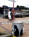
along the railway track. Just about everything in this seaside town had a
penguin theme, right down to their rubbish bins. Yay! We both
agreed from the start to just drive along and make spontaneous stops wherever
and whenever anything of interest catches our eyes. We left Devonport heading
north-west following the scenic coastal route and made the first stop at the
town of Penguin, (first settled in 1850 as a timber town and named for the
Fairy Penguin rookeries common along the less populated parts of the coast) to
admire the lovely flowers blooming in profusion in home gardens as well as all
along the railway track. Just about everything in this seaside town had a
penguin theme, right down to their rubbish bins.  We
had yummy beef pies and a can of Coke each before driving on to Burnie (a port
city originally settled in 1827 as Emu Bay and renamed in early 1840s after
William Burnie, a director of the Van Diemen�s Land Company) to find a chemist
for more �flu medication for my poor sniffling and coughing MOTH but unwilling
to pay any parking fees, we drove on to Wynyard. Wynyard, originally named
Table Cape, is a rural town 16km (10miles) west of Burnie notable for the
scenic attraction of Table Cape. Oh goody! We found a double car space just
outside the chemist and it's free parking! We
had yummy beef pies and a can of Coke each before driving on to Burnie (a port
city originally settled in 1827 as Emu Bay and renamed in early 1840s after
William Burnie, a director of the Van Diemen�s Land Company) to find a chemist
for more �flu medication for my poor sniffling and coughing MOTH but unwilling
to pay any parking fees, we drove on to Wynyard. Wynyard, originally named
Table Cape, is a rural town 16km (10miles) west of Burnie notable for the
scenic attraction of Table Cape. Oh goody! We found a double car space just
outside the chemist and it's free parking!
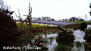
 From Wynyard, �Where Green Meets Blue� (green landscape meets the blue ocean)
we drove towards Smithton (an industrial centre for the surrounding district
with a large timber mill and a potato processing plant) but made a little
detour to see Table Cape Light Station established in 1888, Van Dieman�s Bulb
Farm and the Table Cape Geological Site. [Table Cape is a magnificent example
of a weathered volcanic neck which was once a lava lake (hence its flatness) in
a volcanic structure in a volcanic terrain.] It was a bit late in the season
for the tulips to be in bloom but visitors were not terribly disappointed as it
was the flowering season of Dutch iris (from late Sep till early Dec).
 Row upon row of
the pretty blooms danced gaily in the sea breeze, providing a delightful vision
for all to behold. Row upon row of
the pretty blooms danced gaily in the sea breeze, providing a delightful vision
for all to behold.  After
checking out the historic 25m (82ft) high light station at 190m (623ft) above
sea level, we drove a bit further on to the Geological Site as we didn�t feel
like taking the walking track to get there. The picturesque scenery of well-fed
sheep and gamboling lambs grazing contentedly in a paddock against a background
of the vast fields of multi-coloured blooms and the light station with the
blue, blue ocean to our right would have been worthy of a Wordsworth poem or a
painting by Van Gogh. It would be difficult to find a more delightful view.
Alas, being neither poets nor painters, we brought out our cameras instead. After
checking out the historic 25m (82ft) high light station at 190m (623ft) above
sea level, we drove a bit further on to the Geological Site as we didn�t feel
like taking the walking track to get there. The picturesque scenery of well-fed
sheep and gamboling lambs grazing contentedly in a paddock against a background
of the vast fields of multi-coloured blooms and the light station with the
blue, blue ocean to our right would have been worthy of a Wordsworth poem or a
painting by Van Gogh. It would be difficult to find a more delightful view.
Alas, being neither poets nor painters, we brought out our cameras instead.
 We eventually left the area and drove to the township of Smithton but there was
nothing there that grabbed our attention and besides, there wasn�t a caravan
park in sight so we traveled on to Arthur River after making a phone call to
confirm the availability of a powered site at the Arthur River Cabin Park. Both
the river and the small township were named after Sir George Arthur, Governor
of Van Diemen�s Land (1825-1836). We
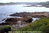 spent the night there and shared the park with a couple of other tourists, a
Maltese couple traveling in a caravan that hailed from Melbourne and another
couple also traveling in a caravan who have been on the road for the last 18
months. Seeing their spare wheel cover with �Di Di Mau� on it, my MOTH knew the
bloke had to be a Vietnam Vet, so the two of them started chin-wagging about
their time in �Nam while I prepared our simple dinner for the night - a portion
of my homemade spaghetti sauce tossed into a saucepan, followed by the contents
of a can of Heinz spaghetti, heated up together and slopped onto hot buttered
toasts and topped with grated cheese. No dessert tonight, just a few homemade
macadamia nut cookies with our coffee. We also shared the $20 a night site with
a whole mob of wallabies but by the time I thought of grabbing my camera half
an hour later, it was too late as they had moved on. Tried to watch a movie on
DVD but all we ended up seeing were the inside of our eyelids!
Day 3 Nov 14:
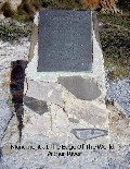
 Left Arthur River at 9.15am, decided to forego the Arthur and Franklin Rivers
cruise and headed to the Edge of the World landmark instead. After reading the
touching poem on the monument, we each cast a pebble into the ocean, snapped a
couple of photos, well ok, a dozen or so� and left the scene. The inscription
on the monument:
THE EDGE OF THE WORLD
North West Coast Tasmania
I cast my pebble onto the shore of Eternity.
To be washed by the Ocean of Time.
It has shape, form and substance.
It is me.
One day I will be no more.
But my pebble will remain here.
On the Shore of Eternity.
Mute witness for the aeons.
That today I came and stood.
At the edge of the world.
Brian Inder
 From Arthur River, we went to check out West Point but after only a kilometre
up the track, a kind fellow tourist driving from where we were heading to,
stopped us to advise that the track further on is pretty rugged - too rough
even for his sedan to tackle. After thanking this kind soul profusely, we did a
turnaround and set off to check out Woolnorth, only to find out an appointment
for a tour of the wind farm has to be pre-arranged! �Stuff that idea!� we
muttered as we left the area and went on to Stanley (the last major township on
the north-west coast named after Lord Stanley, the British Secretary of State
for the Colonies in the 1840s), for a shared lunch of a delicious cray roll,
scallop pie and chicken curry pie from Hursey
  Seafood
Restaurant & Takeaway. After lunch, we decided to snap a few photos of our
surrounds. The owner of the restaurant saw us taking a photo of Seafood
Restaurant & Takeaway. After lunch, we decided to snap a few photos of our
surrounds. The owner of the restaurant saw us taking a photo of
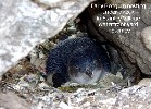
 the �Big Cray� atop
the building and told us about a nesting fairy penguin under some rocks in the
front lawn of Stanley Village Boutique Motel and Restaurant on the waterfront
just across the road. Off we trotted with our cameras and got a few photos of
the wee penguin. From there we ventured up Circular Head, commonly known as
�The Nut� and geologically speaking, is the stump of an old volcano, with steep
sides and a flat top, rising 143m (469ft), like a weird box above Sawyer Bay.
Climbing �The Nut� is a bit like climbing Uluru (Ayers Rock) and no easy feat
as it is a steep and difficult walk that requires fitness and commitment. the �Big Cray� atop
the building and told us about a nesting fairy penguin under some rocks in the
front lawn of Stanley Village Boutique Motel and Restaurant on the waterfront
just across the road. Off we trotted with our cameras and got a few photos of
the wee penguin. From there we ventured up Circular Head, commonly known as
�The Nut� and geologically speaking, is the stump of an old volcano, with steep
sides and a flat top, rising 143m (469ft), like a weird box above Sawyer Bay.
Climbing �The Nut� is a bit like climbing Uluru (Ayers Rock) and no easy feat
as it is a steep and difficult walk that requires fitness and commitment.
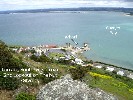
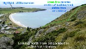 Anyway, we decided to make our way, very slowly, I might add, up the steep
walking track to reach the top and were rewarded with magnificent views of the
peninsula and its surrounds (including the gracious 1830s Highfield mansion
built for Van Diemen�s Land Company chief agent, Edward Curr, on the next
headland), from the two strategically-erected lookout platforms. It wasn�t easy
trying to handle our respective cameras and take photos while tightly hanging
on to the railing for fear of being blown away by the freezing cold gale force
winds but somehow, we managed.
  By
the time we made our way back to level ground via the same steep track, my
knees were trembling and wobbly but I felt triumphant at having made the climb.
Not only did we get some much needed exercise but we also saved $20 (cost of
chair-lift for 2 adults)! We spent the night at Stanley Cabin and Tourist Park
($22 per night) situated with The Nut on one side and the beach of the tranquil
Sawyer Bay on the other. We had a very short leisurely stroll to the beach
before a nice hot shower and dinner of boneless lamb roast with baked potatoes,
carrots and gravy. Dessert was mulberry yoghurt, made by mixing home stewed
mulberries in tub of plain natural yoghurt. Yum! Brief moment of panic when I
started my laptop to jot down today�s events as the battery of my laptop showed
it wasn�t charging. After several attempts at re-booting, it finally dawned on
me that I hadn�t plugged in the power cord. Doh! By
the time we made our way back to level ground via the same steep track, my
knees were trembling and wobbly but I felt triumphant at having made the climb.
Not only did we get some much needed exercise but we also saved $20 (cost of
chair-lift for 2 adults)! We spent the night at Stanley Cabin and Tourist Park
($22 per night) situated with The Nut on one side and the beach of the tranquil
Sawyer Bay on the other. We had a very short leisurely stroll to the beach
before a nice hot shower and dinner of boneless lamb roast with baked potatoes,
carrots and gravy. Dessert was mulberry yoghurt, made by mixing home stewed
mulberries in tub of plain natural yoghurt. Yum! Brief moment of panic when I
started my laptop to jot down today�s events as the battery of my laptop showed
it wasn�t charging. After several attempts at re-booting, it finally dawned on
me that I hadn�t plugged in the power cord. Doh!
Day 4 Nov 15:
We left Stanley at 9.30am and headed for Devonport, stopping at Sisters Beach
for brunch of hastily assembled curried egg sandwiches before continuing on to
Wynyard to get bread (free parking!). 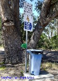 From
there, we followed the coastal road back through Burnie and Devonport,
continuing on to Port Sorell, a sleepy holiday retreat for boating and fishing
enthusiasts, stopping at a roadside fruit barn for apples and garlic. We
checked out Squeaking Point but there wasn�t much there except for a little
jetty and three blokes fishing. From
there, we followed the coastal road back through Burnie and Devonport,
continuing on to Port Sorell, a sleepy holiday retreat for boating and fishing
enthusiasts, stopping at a roadside fruit barn for apples and garlic. We
checked out Squeaking Point but there wasn�t much there except for a little
jetty and three blokes fishing. 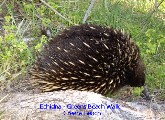 We
travelled on through the Dazzler Range to Beaconsfield but didn't make a stop.
It was onwards to Greens Beach for us to check in at the Greens Beach Caravan
Park where we would be spending the night. After connecting Just Trip'n to the
power supply, we went for a �short� 2-hour return walk along the coastal trail,
where I caught sight of an echidna in the act of scrounging around for its
dinner. Quick as a flash, I whipped out my camera and managed to capture a
couple of shots before it beat a hasty retreat into the bush. As our walk
progressed and as we reached each turn of the trail, all we saw were more
blooming rocks so decided to call it a day. We would check out the West Head
Lookout in the morning on our way out of town. Dinner tonight consisted of
yummy South Australian gourmet beef sausages and fried onions on bread,
followed by dessert of crisp Royal Gala apples before settling in with a movie
on DVD. We
travelled on through the Dazzler Range to Beaconsfield but didn't make a stop.
It was onwards to Greens Beach for us to check in at the Greens Beach Caravan
Park where we would be spending the night. After connecting Just Trip'n to the
power supply, we went for a �short� 2-hour return walk along the coastal trail,
where I caught sight of an echidna in the act of scrounging around for its
dinner. Quick as a flash, I whipped out my camera and managed to capture a
couple of shots before it beat a hasty retreat into the bush. As our walk
progressed and as we reached each turn of the trail, all we saw were more
blooming rocks so decided to call it a day. We would check out the West Head
Lookout in the morning on our way out of town. Dinner tonight consisted of
yummy South Australian gourmet beef sausages and fried onions on bread,
followed by dessert of crisp Royal Gala apples before settling in with a movie
on DVD.
Day 5 Nov 16:
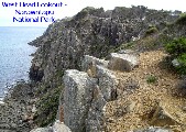
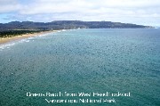 We left Greens Beach Caravan Park about 8.30am and drove through Narawntapu
National Park to get to the West Head Lookout for a bit of a �look-see� and a
hundred clicks of our cameras later, we drove on to view Garden Island just
outside of Kelso. To our great disappointment, all we could see was a sewerage
farm so we gave up in disgust. We then drove to Beaconsfield, near the Tamar
River, north of Launceston, for a look around the gold mine that collapsed on
April 25th 2006.
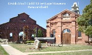
 Beaconsfield was originally known as Cabbage Tree Hill and when gold-mining
began in the 1870s, it became known as �Brandy Creek� and later renamed in 1879
in honour of Benjamin Disraeli, Earl of Beaconsfield, the then Prime Minister
of Great Britain. Afterwards, we had a leisurely walk around the historic park
across the road to admire the beautiful roses in full bloom growing in
 profusion there. We took our time wandering around breathing in the rose-scented air while we peered
through
the windows of the rebuilt/restored old miner�s cottage, the Flowery Gully
School (a one teacher school built in 1892) and an itty bitty general store
 stocked with products of the period. To satisfy our rumblingtummies, we ended
our walkabout and headed across the road to buy lunch of crumbed Blue Grenadier
fillets and chips. As soon as they were devoured, my MOTH cranked up the engine
of Just Trip'n and made our way to Beauty Point to check out Seahorse World. Just as my MOTH
drew out his wallet for the $40 entry fee stocked with products of the period. To satisfy our rumblingtummies, we ended
our walkabout and headed across the road to buy lunch of crumbed Blue Grenadier
fillets and chips. As soon as they were devoured, my MOTH cranked up the engine
of Just Trip'n and made our way to Beauty Point to check out Seahorse World. Just as my MOTH
drew out his wallet for the $40 entry fee
 for 2 adults, he read the sign that said, �Strictly no photography including
digital and video cameras!� so back the money went into his wallet.
 �Don�t seem
to be much point in forking out big bucks if we can�t take any photos!� we
voiced in unison. We marched back to Just Trip'n in disgust and drove back
through Beaconsfield just so I could take a photo of the Exchange Hotel, the
hub of activity during the miners' rescue mission in 2006. �Don�t seem
to be much point in forking out big bucks if we can�t take any photos!� we
voiced in unison. We marched back to Just Trip'n in disgust and drove back
through Beaconsfield just so I could take a photo of the Exchange Hotel, the
hub of activity during the miners' rescue mission in 2006.
That done, we continued on our way, going over the Batman Bridge to get to the
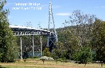
 other side of the Tamar River so we could get to Georgetown, Australia�s oldest
town. We drove up the steep road on Mount George to the Lookout and the
historic Semaphore Station. From the Lookout we could see for miles so we spent
some time there pointing out to each other the various places that we�ve just
visited. From Mount George we drove on to Low Head to check out the Low Head
Lighthouse. This signal station was set up in 1805 and is Australia�s oldest
continuously used pilot station
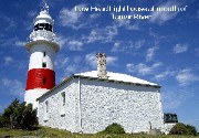 and the light-station established in 1833 was Australia�s third and Tasmania�s second.
 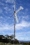 We ended the
day's tour at Bridport Caravan Park with the intention of picking up the
remaining first day's play of the 2nd cricket test match between Australia and
Sri Lanka. As soon as we could, we wound up the TV antenna and watched the live
telecast instead of listening to the live commentary on ABC radio as we had to
while on the road. Tonight�s dinner is Lamb Tomato Curry and Rice followed by
coffee and cookies. Both of us were full to the gunnels so skipped dessert. We
unwound with a TV movie, �Paycheck� before surrendering to sweet slumber to the
sound of waves gently lapping the shore. We ended the
day's tour at Bridport Caravan Park with the intention of picking up the
remaining first day's play of the 2nd cricket test match between Australia and
Sri Lanka. As soon as we could, we wound up the TV antenna and watched the live
telecast instead of listening to the live commentary on ABC radio as we had to
while on the road. Tonight�s dinner is Lamb Tomato Curry and Rice followed by
coffee and cookies. Both of us were full to the gunnels so skipped dessert. We
unwound with a TV movie, �Paycheck� before surrendering to sweet slumber to the
sound of waves gently lapping the shore.
Day 6 Nov 17:
 At 9.15 the next morning, we left Bridport, a popular holiday and commercial
fishing location, to go to Scottsdale before continuing south to St Helens.
 Scottsdale didn�t merit a stop except for a very brief one at a roadside fruit
vendor to purchase half a kilo each of apricots and nectarines. We continued on
the Tasman Highway, merrily chomping on our late breakfast of the fresh stone
fruit until a sign pointing to Ralphs Falls caught our eyes, whereupon, a quick
turn of the steering wheel took us off the highway and into the Legerwood
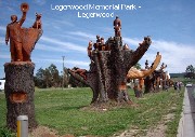
turn-off. Just as we entered the little township of Legerwood, a most unusual
sight in the main street brought us to a screeching halt. We joined many other
tourists to admire some pretty amazing wood sculptures done on nine old tree
stumps in the Legerwood Memorial Park, in memory of the town�s fallen war
heroes.
Having taken a dozen or so photos of this rather unique local landmark, we
jumped back into Just Trip�n and continued on our 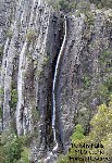 way
to Ralphs Falls. This little adventure involved an 11km (7 miles) winding drive
up Mount Victoria on a rather narrow and rugged gravel road with many a
hair-raising turn, accompanied by some pretty colourful l way
to Ralphs Falls. This little adventure involved an 11km (7 miles) winding drive
up Mount Victoria on a rather narrow and rugged gravel road with many a
hair-raising turn, accompanied by some pretty colourful l anguage intermittently making its way out from between the MOTH�s grimly
clenched teeth. It was such a relief when we finally reached our destination.
We then took a 25-minute return walk to Norm�s Lookout to view the falls.
Ralphs Falls is the tallest single drop fall, plunging some 100m (328ft) off a
cliff. The view of the green valley so far below brought home to us just how
very high up we had driven. The walk down to the Lookout was pretty easy and
took us about 10 mins but couldn�t say the same about the return walk though -
mostly uphill so it took us longer to get back to the car-park and by the time
we reached there, I was a tad puffed.
Instead of going back the way we came, I convinced the MOTH to continue on the
gravel road to the township of 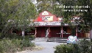 Pyengana
which I secretly hoped would be a better option, thus saving us the harrowing
drive back down the mountain. How glad I was that it was a good decision. We
passed the historical �Pub in the Paddock� but unfortunately, did not stop to
take a photo of it as we didn�t realize its significance until it was too late
to turn around and go back. Further along the Tasman Highway we stopped so I
could take a photo of the �Shop In The Bush�, a bric-a-brac shop specializing
in books, antiques, china, crystal and jewellery, standing proudly on the side
of the highway, in the middle of nowhere. Pyengana
which I secretly hoped would be a better option, thus saving us the harrowing
drive back down the mountain. How glad I was that it was a good decision. We
passed the historical �Pub in the Paddock� but unfortunately, did not stop to
take a photo of it as we didn�t realize its significance until it was too late
to turn around and go back. Further along the Tasman Highway we stopped so I
could take a photo of the �Shop In The Bush�, a bric-a-brac shop specializing
in books, antiques, china, crystal and jewellery, standing proudly on the side
of the highway, in the middle of nowhere.
We continued on our journey to St Helens (the largest fishing port and town on
the east coast, said to be the birthplace of screen legend Merle Oberon), where
we  stopped to buy lunch at the Captain�s Catch seafood caf� on the waterfront.
Clutching our mouth-watering battered Gemfish and chips, we headed back to Just
Trip'n to get out of the wind and enjoy our lunch but just as I got the door
opened, a blooming seagull flew past and shat on my right arm! Oh well, maybe
it was a good omen� We washed down our lunch with icy cold Coke before we
sallied forth for the next township as neither of us was interested in what St
Helens had to offer.
On the way to the next township of St Marys, the MOTH impulsively decided to
check out Mount Elephant, specifically, Elephant Pass, so up the 8km (5 miles)
winding road we went. Luckily, it was bitumen all the way. This cheered the
MOTH somewhat and put him in a happier frame of mind. As we drove on further
and further up Mount Elephant, we came across a road sign that advised �Large
Vehicles Sound Your Horn� just before each bend in the road, so my MOTH happily
complied despite my opinion that the signage are meant for big heavy trucks but
upon seeing his gleeful boyish grin it was hard to stay serious. So on and on
we continued to drive until we finally arrived at the Pancake Cottage situated
about midway on Elephant Pass. We pulled into the car park of the somewhat
ordinary-looking country cottage caf�, gave the posted menu outside a cursory
glance and did a turnaround to get back on the Elephant Pass, back down the
winding road to the Tasman Highway.
No more detours for the day as we drove past the tiny township of St Marys with
its population of 549 (2001 census) and onwards to the seaside township of
Bicheno where we will spend the night at the Seaview Holiday Park. Once
settled, we were again able to follow the live telecast of day 2 of the Cricket
test match. Dinner tonight was fried eggs on toast as we weren�t terribly
hungry after such a hearty lunch.
Day 7 Nov 18:
 We drove out of the caravan park around 9-ish and went to check out places of
interest in Bicheno, (primarily a fishing port, named after James Evernezer
Bicheno, the British Colonial Secretary
 1843-1851) before our departure from this East Coast township. First, we
checked out the diamond-shaped island just outside of town, funnily enough,
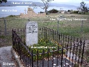
named 'Diamond Island'. We then went to Waubedebar�s Grave - Waubedebar was an
aboriginal who was stolen from her tribe as a teenager to become a "sealer's
woman". Her bravery in swimming out to rescue sealers caught in a storm is
commemorated by a headstone. The Merchant Navy Memorial is situated in the same
park overlooking Waub's Bay. From the park, we drove to the next place of
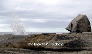
interest, the Blow Hole.
  What an impressive sight it was, of waves pounding into the rocks and gushing
out of the blow hole in a huge spray� and it wasn�t even high tide, thus
revealing the kelp bed close to the shore. From there, we back-tracked to the
Governor Island Marine Reserve and the channel of water between Governor Island
and the mainland called The Gulch. There were at least a million water birds
flying around cawing and squawking away to their hearts� content and loud
enough to wake the dead!
Leaving Bicheno behind us, we traveled south to Coles Bay, a
town on a beautiful bay of the same name on the Freycinet Peninsula, the
entrance to Freycinet National Park. 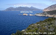 So up we went on yet another mountainous fairly winding road to the Cape
Tourville Lookout to be awed by magnificent views of Carp Bay and Thouin Bay
with numerous buoys marking what we assumed to be crayfish pots. A hundred or
so of photos later, we drove back down to the township of Coles Bay and onwards
to rejoin the Tasman Highway. On the way in, a roadside sign on Coles Bay Road
advertising �Freycinet Marine Farm - Fresh Oysters and Mussels� caught our eyes
so we decided to stop there on the way out. How pleased we were with this
decision as we sat down to a scrumptious lunch of a dozen large freshly shucked
Pacific oysters and a huge bowl of steamed mussels served with slices of lemon.
Ah� this is the life!
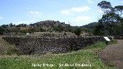 After lunch it was back onto the Tasman Highway heading south, driving through
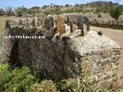
the township of Swansea and making a brief stop to check out Spiky Bridge, a
convict bridge built in 1843, 7.5km (4.7 miles) south of Swansea, constructed
from fieldstones laid without mortar or cement. This unusual bridge wasn�t
named after anyone of importance but rather because of the fieldstones laid
vertically on the parapet like spikes, supposedly, to prevent cattle from
falling over the sides.
  We reached historic Triabunna (an Aboriginal Tasmanian word for the endemic
Tasmanian native hen), the largest township on the east coast, sheltered within
Spring Bay at the mouth of MacCleans Creek and Vickerys Rivulet which started
as a garrison town for the penal colony on Maria Island. We checked into the
Triabunna Caravan Park just in time to catch the live telecast of Day 3 post
afternoon tea play of the Cricket Test match.
 When
the televised cricket match ended for the day, we grabbed the town walk
visitor's guide that we had acquired earlier from the Visitor Information
Centre and went for a stroll along the Esplanade with a view of Dead Island
(Isle of the Dead) which was used as a burial ground for twenty years
(1847-1867). Continuing on our walkabout, we checked out the historic Spring
Bay Hotel which was built in 1861 and originally known as Pembroke Hotel. Next
on the list was the Old Barracks & Stables, built by George Rudd in 1843
when the 51st When
the televised cricket match ended for the day, we grabbed the town walk
visitor's guide that we had acquired earlier from the Visitor Information
Centre and went for a stroll along the Esplanade with a view of Dead Island
(Isle of the Dead) which was used as a burial ground for twenty years
(1847-1867). Continuing on our walkabout, we checked out the historic Spring
Bay Hotel which was built in 1861 and originally known as Pembroke Hotel. Next
on the list was the Old Barracks & Stables, built by George Rudd in 1843
when the 51st 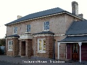 Regiment
from Maria Island was stationed at Spring Bay. A few yards further on stood
Triabunna House which was originally built as a hotel and became the
Robertson�s family residence in 1875. Later on, it operated as a boarding house
(from 1906 to the 1930s) as Misses Robertson�s Boarding House. The Colonial
House, the present day Sufi�s Craft Shop & Tea Rooms, was once the home of
the McGrath Family built in the 1880s. When we got to a little takeaway shop
across the road from Sufi's, we decided to have a takeaway dinner - hamburgers
with the lot, minus bacon, of course. On the way back, we passed the
Magistrate�s Cottage, built in the 1840s and used until 1861. Regiment
from Maria Island was stationed at Spring Bay. A few yards further on stood
Triabunna House which was originally built as a hotel and became the
Robertson�s family residence in 1875. Later on, it operated as a boarding house
(from 1906 to the 1930s) as Misses Robertson�s Boarding House. The Colonial
House, the present day Sufi�s Craft Shop & Tea Rooms, was once the home of
the McGrath Family built in the 1880s. When we got to a little takeaway shop
across the road from Sufi's, we decided to have a takeaway dinner - hamburgers
with the lot, minus bacon, of course. On the way back, we passed the
Magistrate�s Cottage, built in the 1840s and used until 1861.
 Enough
exercise for one day, we decided, so back we went to the Caravan Park to wolf
down our �burgers, followed by a long hot shower before settling in for the
night with the MOTH watching TV while I re-capped today�s events on my laptop.
On the stroke of midnight, my MOTH handed me a cute hand-made birthday card he
had painstakingly drawn while I was busy with my daily report. All the walking
we�d done meant we had no trouble going to sleep that night, heading off to
slumber-land as soon as our heads touched our pillows. In the morning, we�ll be
continuing our southbound journey to Port Arthur on the Tasman Peninsula� Enough
exercise for one day, we decided, so back we went to the Caravan Park to wolf
down our �burgers, followed by a long hot shower before settling in for the
night with the MOTH watching TV while I re-capped today�s events on my laptop.
On the stroke of midnight, my MOTH handed me a cute hand-made birthday card he
had painstakingly drawn while I was busy with my daily report. All the walking
we�d done meant we had no trouble going to sleep that night, heading off to
slumber-land as soon as our heads touched our pillows. In the morning, we�ll be
continuing our southbound journey to Port Arthur on the Tasman Peninsula�
OzLadyM
  
Border: BoogieJack
Copyright � 2008
OzLadyM
Please do not use any material on this website without my permission. Thank
you.
|
 TASMANIA, AUSTRALIA'S APPLE ISLE - Nov 2007


